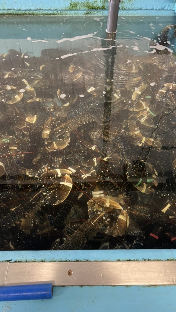
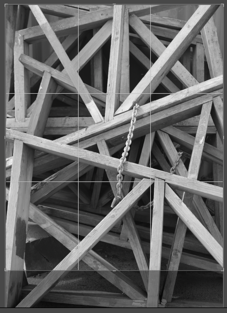
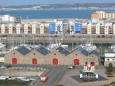
This is the front cover of my zine. I really like this photo as it is compositionally and contextually interesting. This makes it perfect for a noticeable front cover. I also wanted to have a straightforward title that could directly link to what the images inside display; the fishing industry of St Helier Harbour.
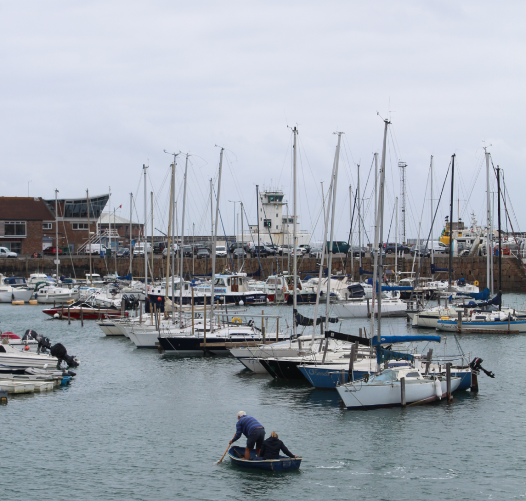
This is the first page of my zine when you open it up. I have put this here as it is an overview shot of the harbour, featuring many fisherman boats at the Old French Harbour.
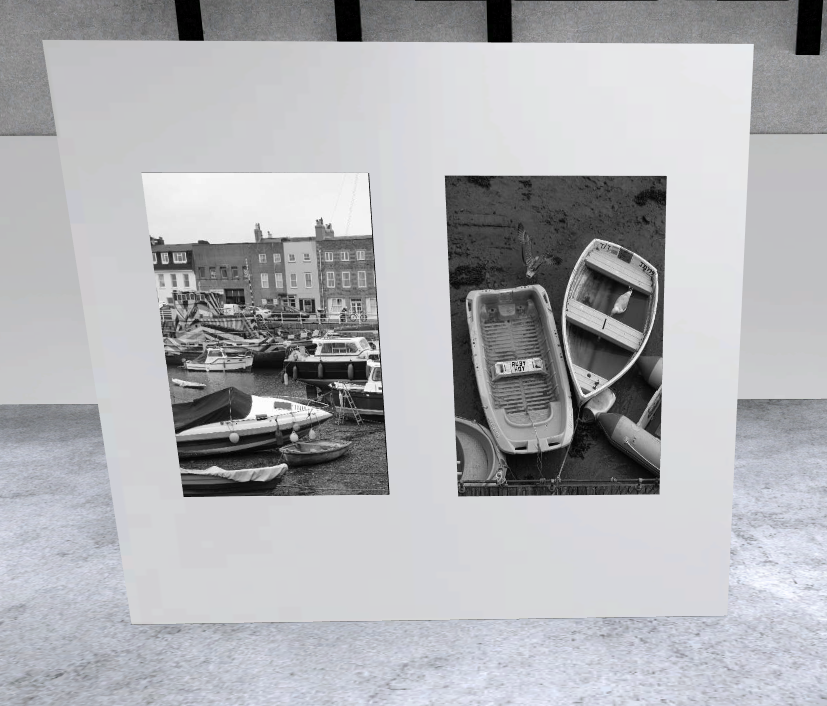
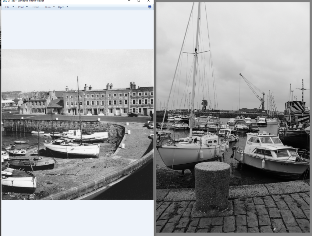
For this page, I wanted to display an archive image with one that I have taken. I have chosen these images as they are the closest match out of all my photos and I have made them the same size on the page.
This is the next page of my zine and I wanted it to display the fisherman at St Helier Harbour as part of the fishing industry. I have made the image on the right larger as it will be the first you see when you turn the page and I personally prefer the image as the one on the left has a blurred background. This is also why I have made it smaller.
Both images on this page display men working on their boats, one of them pressure washing and the other welding. I have made the image on the left a full page to draw the viewers’ attention to it as when they turn the page over they will initially gaze to the right.
On the right is a fisherman, Will, doing his job and on the left is where he works. I have made the image on the right larger so that it matches the layouts of the rest of the pages.
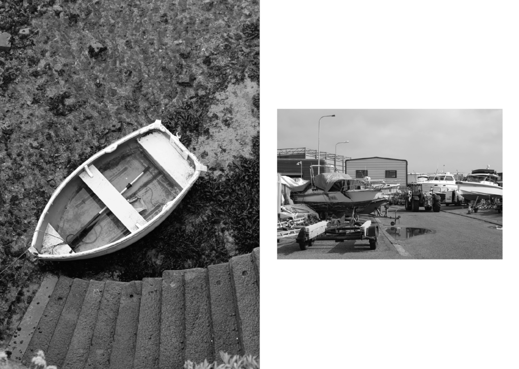
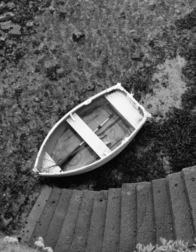
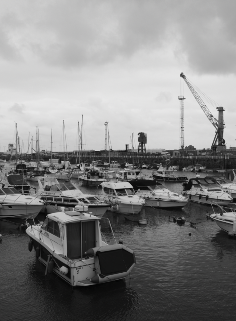
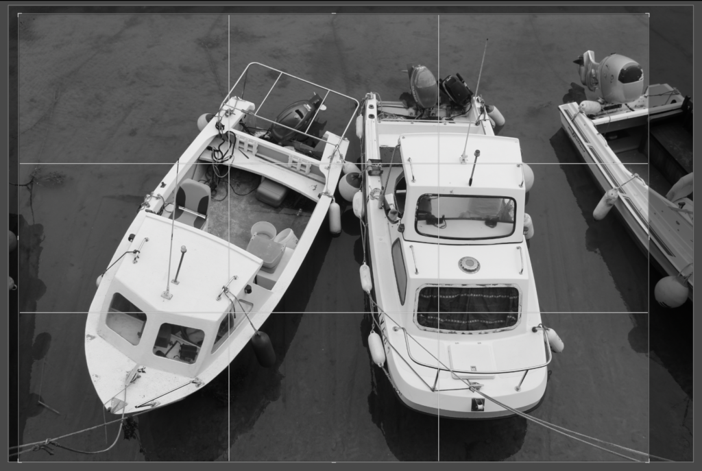
This page displays stationary boats. There is juxtaposition between these 2 images as one is the seabed and the other is on land.
This is my last pages of my zine. I have made these also a double page, similar to the front pages so that there is balance within the zine. I have aligned this image so that the page splits between the 2 boats.
This is the back cover of my zine. I have photoshopped my name onto the number plate as the original number plate had the same amount of letters. I also used this photo as it features a seagull with open wings in negative space which makes the image more interesting, whilst also engaging the viewer.
Evaluation
Overall, I think that my zine well presents the narrative I was going for and is cohesive and well thought out. I have started off the zine by displaying an overview of the harbour with an archive image to demonstrate how it has changed over time. This then links to the fisherman within their work environments, the harbour. Finally, the zine comes to an end displaying fishing boats tethered in different locations. My zine also holds a continued theme of black and white images throughout which helps keep the cohesiveness and remove any distractions caused by bright colours.
I am not very satisfied with this page as I don’t feel like it fits in with the rest of the zine or with the narrative I am trying to display (fishing industry), therefore, I am going to find an archive image that is similar to one that I have taken and display them together.
Use of Archive Images
These are my two options of archive photos. I am going to go for the first option as it is more clear that they were taken at the same place and they still relate to the fishing industry, therefore, will fit in with the rest of the zine.
I re-edited this photo and lowered the clarity so that it would fit in better with the archive one.
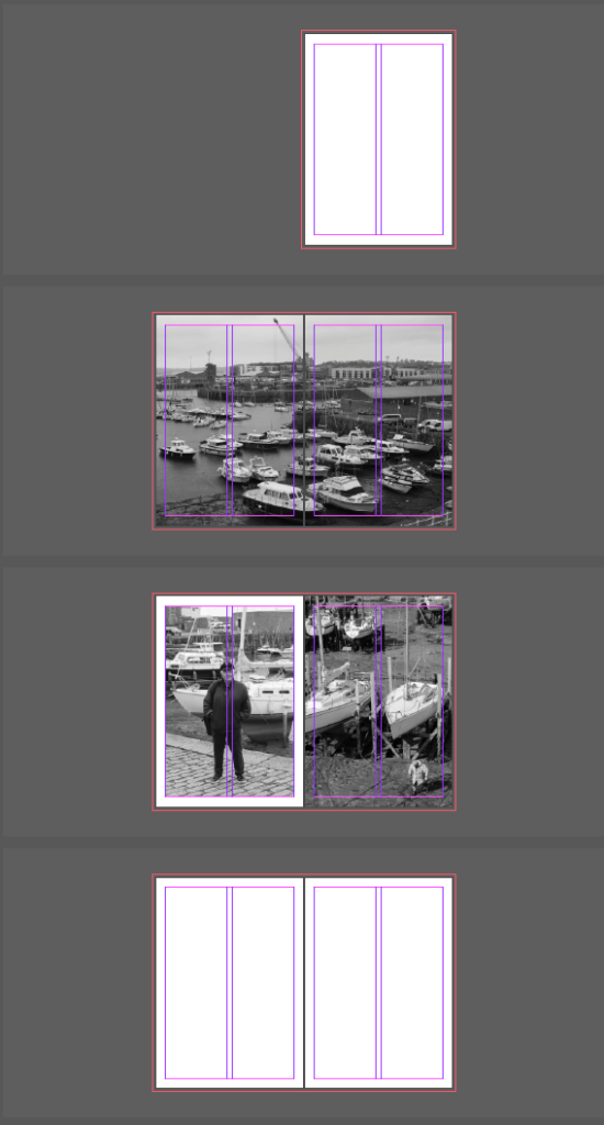
I then rearranged the pages to what I thought was a more suitable layout:
I then added the title ‘St Helier Harbour’ to my front cover.
I then decided to put the subtitle ‘Fishing Industry’ below.
I then changed the layout of some of my pages to get a more efficient layout overall:
My zine is going to tell a story about the fishing industry in Jersey at St Helier Harbour.
A paragraph
My zine will tell the story of the lives of the fisherman at St Helier Harbour. The story will be displayed through photos of fisherman and the activities they get up to from day to day. Finally, it will present their surrounding environment as an overview of their lives.
Narrative
I am going to tell my story by presenting various images that relate to the fishing industry in Jersey. These will include things such as fisherman boats, fishermen and men working on their boats. I will also display images of the harbour and potentially even an archive image to show its development over the years.
Selection of Images
Final Edits
Selection After Elimination
Mock-up on Paper
I have made a mock-up zine using 4 folded sheets of A4 paper and my selected images which I printed out.
Editing name into image
I started off editing this photo in Photoshop by using generative fill to remove the text.
I then selected and copied and pasted number plate letters across. I got these letters from an image on google which I then opened in Photoshop.
I then put the letters in to place by using the original image and putting my letters on top so that they were the same size and position.
Camera Obscura is a natural phenomenon in which you have a dark room/chamber and allow light rays to pass through a small hole. These light rays will project an inverted image of the view from outside onto a surface within the dark room. This is similar to how a modern camera works as the camera is the dark chamber and the hole for light is the aperture. The mirror in modern cameras flips the image around so it is no longer upside down. Furthermore, in the 16th century, camera obscura became a popular drawing and painting aid as people would use the projected image to trace it.
Here is an example of the use of camera obscura. This took place in Venice in 2006 and depicts a projection of Santa Maria della Salute on a bedroom wall.
Camera Obscura is still used to this day, an example being the work of Susan Derges. Susan Derges works with nature to produce her images by going out at night and submerging light sensitive paper under water, allowing the moonlight to transfer the image on to the paper.
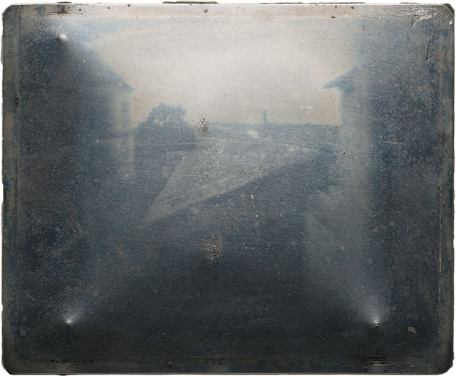
Joseph Nicephore Niepce was a French Inventor and Photographer, born in 1765. Niepce lacked in artistic ability so used Camera Obscura as a drawing aid, in which he later used to create the process ‘heliography’. He created this process in 1822 and used it to capture the World’s very first permanent photograph. This photograph was of Pope Pius VII, however, it was later destroyed after Niepce attempted to make prints from it. In 1816, Niepce would send letters to his sister-in-law containing small images on paper coated with silver chloride, however, they were negatives and when they were exposed to light for viewing they would go dark all over. Niepce then explored other substances that were affected by light and became intrigued by how bitumen coating would become less soluble after being left exposed to light. This went on to his creation of the heliograph where he would dissolve bitumen in lavender oil and use it to coat either a lithographic stone, a sheet of metal or a sheet of glass and leave it to dry. He would then cover it with an engraving printed on paper and leave it in direct sunlight so that, after sufficient exposure, he could use the lavender oil to rinse away the unhardened bitumen which had been sheltered from sunlight by the lines/dark areas in the engraving. Finally, he would etch the remaining details in with acid. Later, after Niepce’s passing in 1833, his invention was overshadowed by the invention of his partner’s Daguerreotype, an improvement of the Heliograph.
Niepce’s first ever saved image – taken between 1822 and 1827 at Le Gras, France
Louis Daguerre was a French artist and photographer, recognised for inventing a way to fix the projected image of Camera Obscura, known at the Daguerreotype. The invention of the Daguerrotype was announced on the 19th of August, 1839 at a meeting of the French Academy of Science in Paris. A Daguerrotype is sometimes referred to as a ‘mirror with memory’ and it was originally made by, first, polishing a sheet of silver-plated copper to look like a mirror then making it sensitive to light by using Iodine in a closed box. After this, camera obscura was used to expose the surface to light and create an image. This would take a range of 3 to 15 minutes. Finally, this image was fixed by desensitising the sheet to light using sodium thiosulfate or salt with gold chloride.
Daguerrotype of Louis Daguerre in 1844
The surface of daguerrotypes are very delicate and they can be ruined just by wiping them, therefore, they were often blowtorched around the edges to be sealed and put into protective cases/picture frames.
Henry Fox Talbot was an English scientist, inventor and photographer who invented a photographic process known as the Calotype, otherwise known as the Talbotype. This was an improvement over the Daguerreotype as multiple prints could be made from it and the exposure time was only a couple of minutes, however, the Daguerreotype could only be reproduced by copying it with a camera and took longer for the photo to be produced. Prior to the Calotype, Henry created a process known as the “photogenic drawing” process which produced paper negatives on light-sensitive paper with silver salts. This was similar to Nicephore Niepce’s Heliograph, however Talbot found a way to prevent the photographs from darkening when being again exposed to sunlight. The Calotype was a modified version of this process with a faster exposure time and development process and it allowed negative prints to be made positive through contact printing.
Below is the earliest surviving negative by Talbot, depicting the lattice window at Lacock Abbey, made in August 1835.
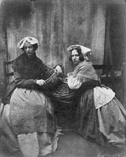
William Collie was a photographer who was born in Scotland in 1810 but moved to Jersey in 1841. He was one of the earliest photographers in the Channel Islands and had a portrait business at Belmont House in St Helier. Collie was the first known photographer to use this photographic process in Jersey and in the late 1840s made a series of Calotypes depicting ‘French and Jersey Market Women’.
William’s photograph of Jersey market women, taken in 1847, one of the earliest photographs printed on paper.
Robert Cornelius, born in Philadelphia in 1809, was an inventor, businessman and lamp manufacturer. He worked for his father in his lamp shop and specialised in silver plating and metal polishing. After being hired by a Client to produce a silver plate for a daguerreotype, Cornelius became intrigued by the process.
At just 30 years old, Robert Cornelius was believed to have taken the world’s very first portrait in 1839. He took this image just two months after the announcement of Daguerre’s Daguerreotype outside the back of his family’s store in Philadelphia. He created this portrait by removing the lens frame and running to stand in front of the camera completely still for 10-15 minutes then covering the lens back up. Cornelius wrote on the back of this Daguerreotype “The first light Picture ever taken. 1939.”
Robert Cornelius’ Self Portrait
Henry Mullins – Carte-de-Visite
The Carte de Visite, translating to ‘visiting card’, was a small photographic portrait, typically 54 x 89mm in size mounted onto a piece of card 64 x 100mm in size. They became increasingly popular in the 1860s and were exchanged among friends and family to create albums.
Collection of Carte de Visite photographs
Henry Mullins was a photographer who moved to Jersey in 1848. Between his relocation in 1848 to 1873, Mullins produced thousands of photographs of Islanders, with almost 10,000 available to view online. He owned a successful studio in the Royal Square in St Helier and was the photographer of choice for the Island’s leading members and wealthy families.
Carte de Visite of Henry Mullins along with some photographs of his Clients
Richard Maddox
Richard Leach Maddox, born in England in 1816, was a photographer and physician who, in 1871, invented lightweight gelatin negative dry plates for photography.
Example of a Negative Dry Plate
Example of Dry Plate
These dry plates are an adaption to Frederick Scott Archer’s Collodion process, which was invented in 1851. These plates had to be sensitised at the time of exposure, meaning that the emulsion was still wet and produced ether vapour which can affect a person’s health.
Richard Maddox’s dry plates consisted of a glass plate coated with light-sensitive gelatine emulsion that was left to dry before use. This allowed photographers to use commercial plates off a shelf, rather than have to prepare their emulsions. It also allowed for cameras to be smaller and have faster exposure times. This process was developed and eventually led to the ‘Kodak’ Camera.
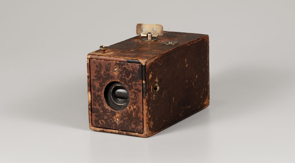
George Eastman was an American entrepreneur, born in New York in 1854, who founded the Eastman Kodak Company. Kodak being a word he created himself. Due to the passing of Eastman’s father, he had to leave school at the age of 14 to support his family financially. In the 1870s, whilst George was working as a Bank Clerk, he became interested in photography and, in 1879, created a machine for coating dry plates. In 1881, alongside Henry Strong, George founded the Eastman Dry Plate Company. He then began experimenting with film roll to replace plates and invented the Kodak Film Camera, in which he released in 1888.
The first Kodak Film Camera, 1888
This camera could be hand-held and was designed so that it was simple for anyone to use, with just the click of a button. Additionally, the camera was pre-loaded with enough film for 100 photos, priced at $25, and once the film had been used up it could be returned to develop the film and have new film inserted for $10. Eastman’s slogan was “You press the button, we do the rest”.
In 1990, Eastman Kodak released the Brownie Box Camera, a camera designed for use by anyone, including children. The initial price of the Brownie was just $1, equivalent to $37 in 2023, due to it being a basic cardboard box camera with simple controls. This became an increasingly popular camera for photography and many other models of it were later created by Eastman Kodak.
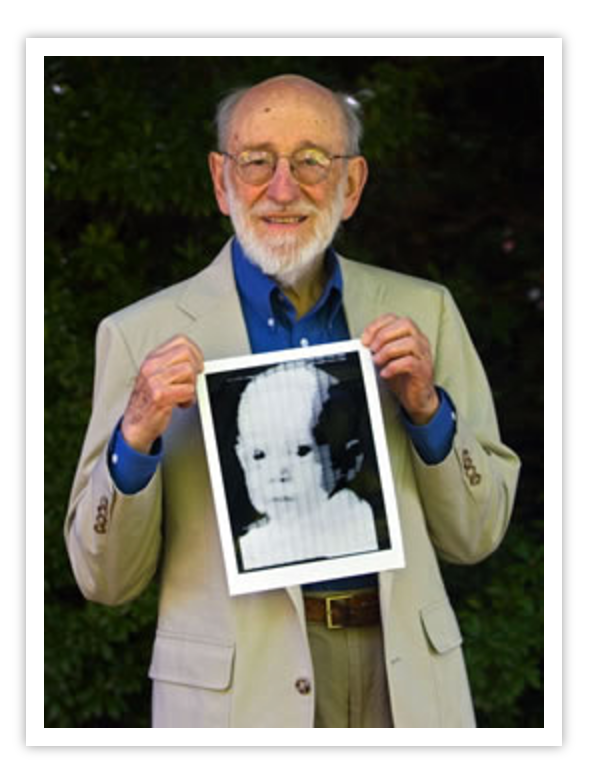
Digital Photography first came in to being in the 1950s when the first video tape recorders were developed in 1952. Later, in 1957, Russel A. Kirsch created the first ever digital image. It was a portrait of his son which he produced using a Drum Scanner, technology that could sense the differences between light and dark in an image.
Russel Kirsch holding the very first digital photograph, a portrait of his son.
In 1969, Willard Boyle and George Smith invented CCD (charged-coupled device) chips. These could be used in video cameras and by 1975 CCD cameras were being used for broadcast television. In December 1975, Steven Sasson, an electrical engineer and inventor at Eastman Kodak, produced the very first true digital camera using CCD chips. This was a large, battery-operated, self-contained camera, weighing 8 pounds, with a resolution of 0.1 megapixels and image production time of 23 seconds. The images from this camera were digitally recorded onto a cassette tape.
Steven Sasson with his Kodak Digital Camera
From then on, digital camera technology has continued to evolve to this day and they are now everywhere, from DSLRs to phones, computers, cars and more.
We are going on another photography trip and during this trip we will be doing another 2 photoshoots, one at Victoria Pier and the other to La Collette Yacht Basin. Additionally, we will be visiting the Jersey Maritime Museum. My plan for these photoshoots are the same as the previous 2, however I would also like to try and get more Abstract shots.
Image Selection
Image Sub-Selection
Edits
People
Edit 1
Edit 2
Edit 3
Edit 4
Edit 5
Edit 6
Here I used the brush tool to increase the exposure and highlights in this area so that the boat is more visible.
Edit 7
Abstract
Edit 1
Edit 2
Edit 3
Edit 4
Edit 5
Edit 6
Edit 7
Edit 8
Edit 9
Edit 10
Edit 11
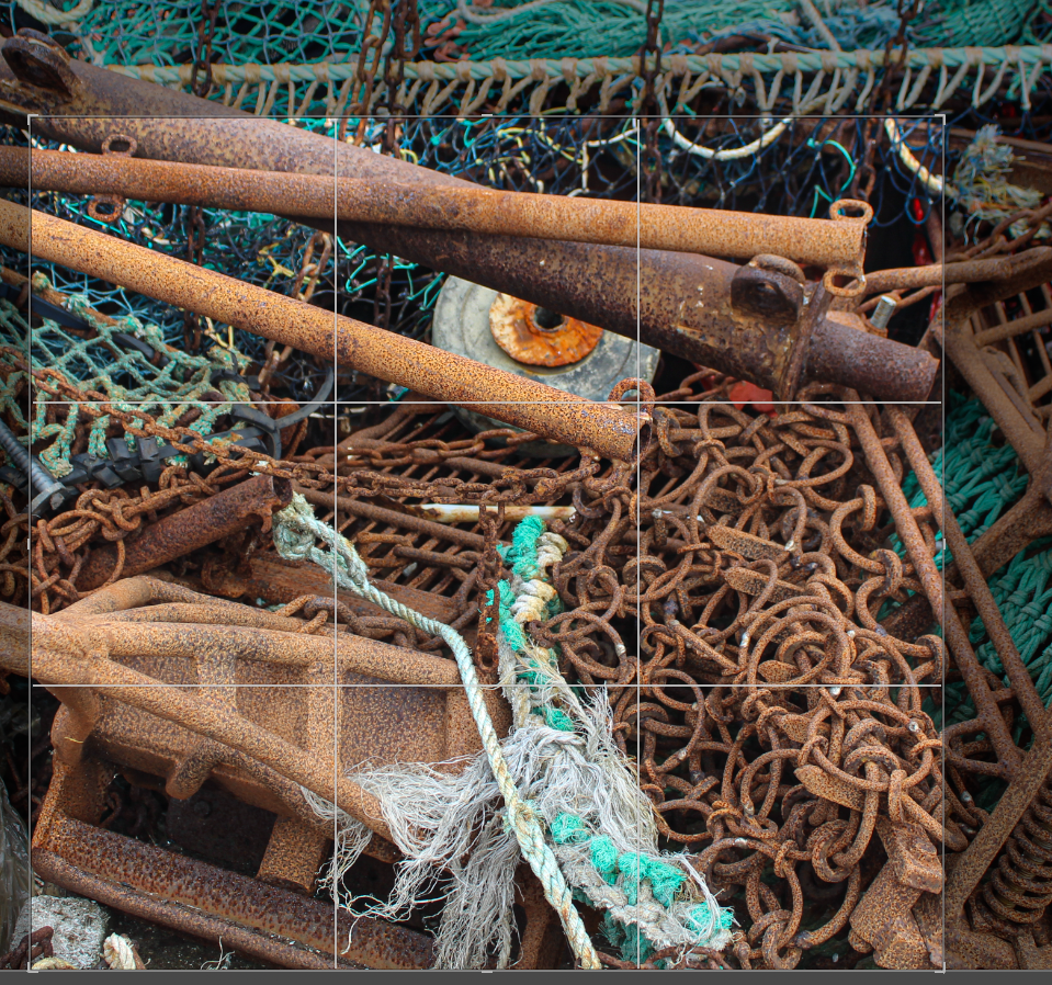
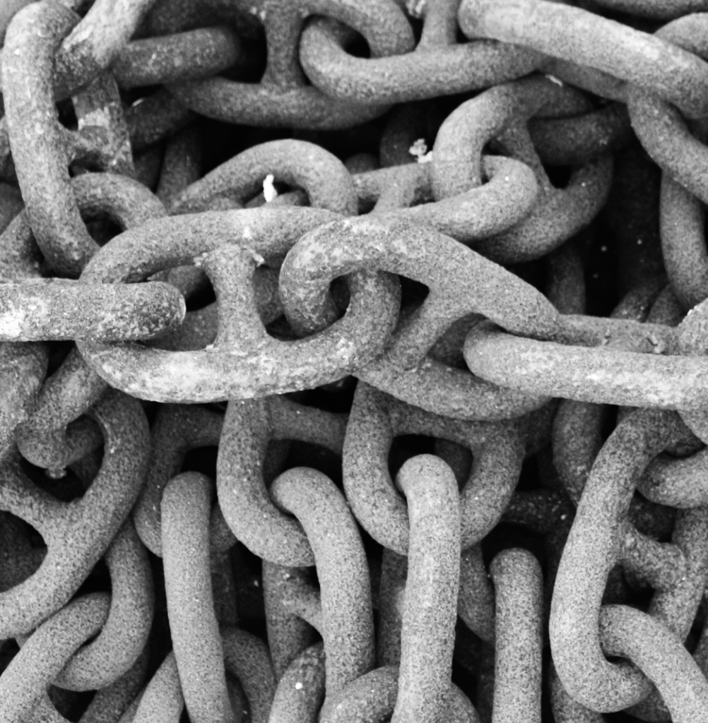
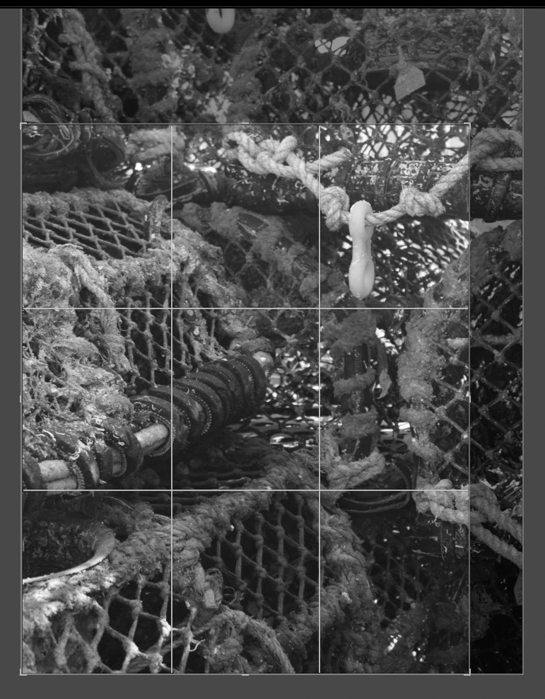
I then put this image in B&W and increased the contrast as I think it looks more effective and best highlights the details in the rope.
We are going on a photography trip and during this trip we will be doing 2 photoshoots, one at the Old English and French Harbours and the other at Albert Pier. During these photoshoots, I am going to photograph the harbour to show how it has changed over time. I am also going to find some old images of the area and try to recreate them, showing the new surroundings.
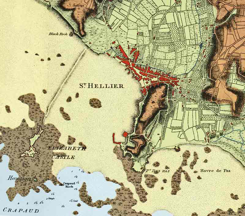
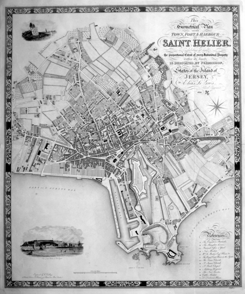
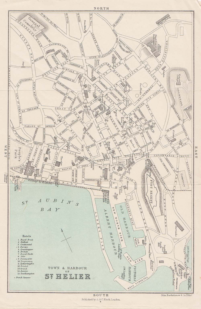
St Helier Harbour is the main Harbour of Jersey and it is located on the south coast. Here are some maps of St Helier Harbour showing how it has developed over time:
St Helier Harbour in 1790, consisting of one small pier, also known as the Old English and French Harbour.
1834 map, including New North Quay Pier.
1898, Albert Pier and Victoria Pier were built.
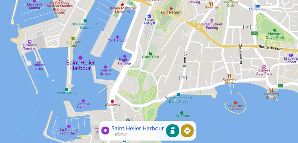
Current Map
Development of St Helier Harbour
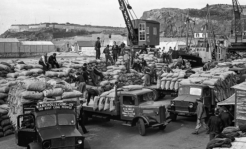
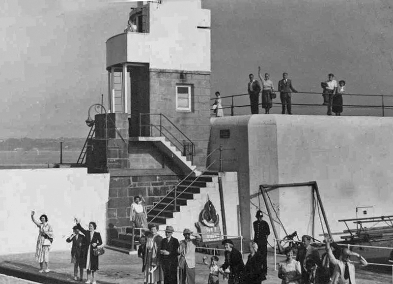
The Old English and French Harbours were the first parts of St Helier Harbour. The Old Harbour originally consisted of just a jetty until it was upgraded with a new breakwater in 1790, New North Quay.
Coal Delivery on New North Quay
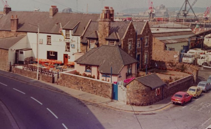
In 1814, the merchants constructed roads to connect the harbour to town. These roads are now known as Commercial Buildings and Le Quai des Marchands. The Old Harbour also includes South Pier and the abandoned pub, La Folie Inn.
La Folie Inn
Due to the growth in Jersey’s fishing fleet, work commenced on the new South Pier in 1841, which was later named Victoria Pier, following Queen Victoria’s visit to the Island. This pier was completed in 1846 and it now is home to fish wholesalers such as Fresh Fish Company and Aquamarine Fisheries.
The following year, they had began work on Albert Pier.
Albert Pier
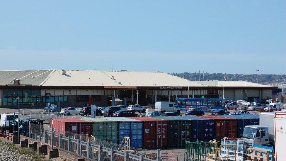
Albert Pier was originally a ferry terminal due to its deep water berths, however, it has now been re-developed to berths for large vessels and yachts and the ferry terminal is now located at Elizabeth Harbour. This Harbour was constructed in the late 1980s on reclaimed land and the terminal was opened by Queen Elizabeth II on the 25th of May 1989.
Elizabeth Harbour Terminal and trailer park
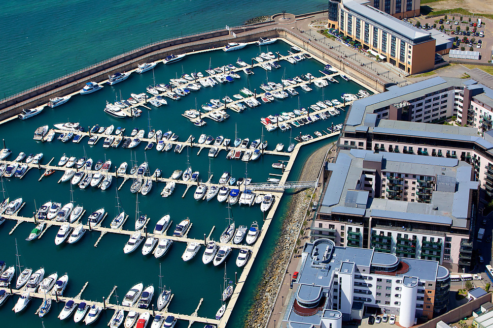
There are now three main Marinas at St Helier Harbour:
La Colette Yacht Basin
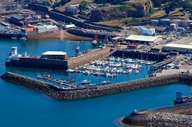
La Colette Marina
This Marina is home to Jersey’s commercial fishing fleet and it is the only one of the three marinas to provide non-tidal, 24-hour access to the sea.
St Helier Marina
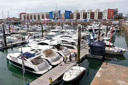
St Helier Marina in 2012
St Helier Marina, constructed in 1980, is mostly used for berthing private yachts. To the west of this Marina is Albert Pier and to the East is New North Way, home to Jersey’s Maritime Museum.
Jersey’s Maritime Museum and St Helier Marina.
This Marina has been the venue for the annual Jersey Boat Show since 2008.
Elizabeth Marina
Elizabeth Marina
Elizabeth Marina is the newest of Jersey’s Marinas. Work began to construct this Marina in 1996 and it was completed 2 years later. This Marina has 600 berths and was constructed on reclaimed land. This area also includes Jardins de la Mer, La Frigate Cafe, the Waterfront Car Park, the Radisson Blu Hotel, Castle Quay and a Leisure and Pool complex.
The Channel Islands consist of Jersey, Guernsey, Alderney, Sark and some smaller islands which were all separated from mainland Europe as a result of the rising sea levels during the Neolithic period. Following this event, maritime activity commenced due to islanders wanting to earn money through trade and investing capital in maritime business. From the 15th to late 18th centuries, trading became more popular due to the technical improvements of ships and navigation, allowing people to sail for days on end. This increase in trade lasted up until the Napoleonic Wars.
The Merchant Triangle, also known as the Atlantic trade
Through trading, the Channel Islands were given concessions such as dried cod from Newfoundland and Gaspe coast, cloth, wine, wool, leather and household goods. After the opening of Grand Bank fisheries, one of the World’s richest fishing grounds (located South of Newfoundland), Jersey and Guernsey formed colonies which would catch fish and dry them. Cod was very valuable at this time and they would exchange this fish in the West Indies and later Brazil too for plantation goods such as sugar, molasses, rum, cotton, coffee and tobacco.
Map of Canada Atlantic provinces, including Newfoundland and Gaspe coast.
Charles Robin
Charles Robin, one of Jersey’s premier cod-merchants, founded the Charles Robin Company in 1766. This was a company based in Gaspe where they produced and sold cod. Robin produced 2 different types of salted cod, green and yellow. Green cod was wet salted cod which was not dry-cured and yellow had been dry cured. Robin would often sell his green cod in markets in the Caribbean or North East Brazil as it had a shorter shelf-life than yellow cod. In exchange for the green cod, Robin would receive plantation goods which he then would trade in the Mediterranean, England and Jersey. For yellow cod, Charles Robin would sell it in markets in Europe, mainly Portugal, Spain and Italy as they had Large Roman Catholic populations. At this time, Roman Catholics had a high demand for fish due to them only eating fish for the day each Friday. This cod-fish was traded for products such as wine, fruits, spirits, spices and salt (used in the curing process). They then brought these goods to Jersey and British ports before returning to Canada.
Charles Robin Company headquarters in Gaspe, now a museum
Overall, the Island benefitted from the profits made in the British Empire at this time, which were highly built on the slave trade during the Industrial Revolution. This is due to slaves being the ones who would farm the goods to be traded. Additionally, there is evidence that ships would leave St Helier Harbour with supplies to be taken to slave stations in West Africa. An example is Cape Cod Castle on the Gold Coast of Ghana. This was a fort which was highly involved in the Transatlantic Slave Trade.
After being introduced to InDesign in class, I played around with the tools to become familiar with the Software and this is what I created. As you can see, I have inserted some random images. These images won’t be the selection that I will use for my final design, I just used them to learn how to add images and move them around.
These are some other layouts which I came up with and, as you can see, I have decided to go for the title ‘Within the Walls’. Another good title would be ‘St Malo through Phone’ as I took these images using my iPhone as it is more distinct, however, I think this title would be informal and doesn’t look as good.
I then added some placeholder text in the areas which I am planning on putting text within my Page Spreads.
I also added the French flag behind one of my layouts by using coloured shapes and sending them to the back.
Another layout option which I tried was to have an image behind the text. I inserted this image like I would any other then moved it to back and lowered the transparency to 24%.
I also added some borders around my images which are the colour of the French flag as it is much more minimal than having it as the entire background. I did this by making the edges of the images have a 3pt border then colouring the borders to be like the French flag.
I designed another layout with some more smaller images, rather than having a clear establishing shot. This will allow me to display more of my images and works better for my images as the majority of them are vertical.
After this, I added images to one of my design layouts, as seen below:
Here is my reasonings for each of the images’ positions:
I also tried this same layout in B&W to see what I think would look best:
I have decided that I am going to keep the images in colour as I believe that it is more pleasing to the eye and St Malo is a very colourful place so it represents it well.
After this, I put an image of a woman eating ice cream behind the text to see how it would look, however, I think that it just looks a bit messy.
Here is another image layout which I have created:
I made this page spread monochrome by exporting it and putting it into Lightroom, rather than using B&W images.
Once again, I think that I prefer in colour as it strips the character from the images when in B&W.
These are the 2 layouts for me to choose between:
I have decided to go for the second layout as I think it is a better way of positioning the text and will allow me to write 2 separate paragraphs on different topics, rather than one big one. One the other hand, there are some images which I don’t think quite fit with the rest, therefore I am going to change them.
I have swapped the image with the church to the one where the man is walking past the 2 ladies sipping their drinks. I prefer this layout much more now compared to how it was before and I think that this image is a better representation of the decisive moment.
I then made another change to my images as I thought the image of the woman eating the ice cream didn’t really fit in so I replaced it with the image of the man cycling and replaced that image with people walking their dogs. I strategically placed these images here as they draw your eyes into the page spread.
This is the text I would like to add to my page spread:
1st text box:
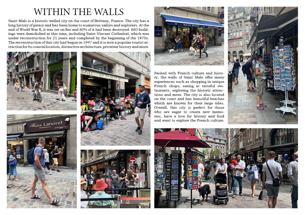
Saint Malo is a historic walled city on the coast of Brittany, France. The city has a long history of piracy and has been home to numerous sailors and explorers. At the end of World War II, it was set on fire and 80% of it had been destroyed. 680 buildings were demolished at this time, including Saint-Vincent Cathedral, which was under reconstruction for 21 years and completed by the beginning of the 1970s. The reconstruction of this city had begun in 1947 and it is now a popular tourist attraction for its coastal location, distinctive architecture, privateer history and more.
2nd text box:
Packed with French culture and history, the walls of Saint Malo offer many experiences such as shopping in unique French shops, eating at tasteful restaurants, exploring the historic attractions and more. The city is also located on the coast and has beautiful beaches which are known for their large tides. Overall, this city is perfect for those who are eager to create new memories, have a love for history and food and want to explore the French culture.
Here are my layouts with text:
I have decided to go for the first text option as I think that it best fits the boxes I have left for text and also matches the title as they are both serif fonts. I have also put made sure that the text was displayed with my most recent layout. Here is my final result:
Picture stories are a sequence of images that tell a story when displayed together. These types of stories don’t require words to convey the message as the images speak for themselves.
Examples of Picture Stories
Different Types of Images in Picture Stories:
Establishing Shot
Establishing shots are often images which can provide an overview on the topic of the picture story and they are usually displayed larger than the rest of the images. They also may display important locations and details which can be seen in other images to tie them together.
Relationship Shot
Relationship shots are shots which capture the connection between two or more people, objects, animals, etc. An example of a relationship shot could be a couple after their engagement.
Detail Shot
A detail shot is a photograph which clearly focuses on the details and textures of a particular subject. An example of a detail shot could be portrait mode on an iPhone, where the background is blurred and subject clear.
Environmental Portrait
An environmental portrait is a type of image that displays the subject in their usual environment, such as their home or workplace.
Formal Portrait
A formal portrait is a typical portrait of a person where poses and lighting conditions have been carefully arranged to get the best shot.