A Geopark is defined as a unified area that advances the protection and use of geological heritage in a sustainable way, and promotes the economic well-being of the people who live there. A Geopark tells the whole story of an area, right from the very beginning. We think that Jersey – which has been shaped by tide and time – should have this designation because of the Island’s exceptional geology, unique heritage, amazing landscapes and special seascapes.
Every Geopark is unique. There are 169 UNESCO Global Geoparks in 44 countries around the world. United Nations Educational, Scientific and Cultural Organization (UNESCO) seeks to build peace through international cooperation in Education, the Sciences and Culture.
“UNESCO Global Geoparks are single, unified geographical areas where sites and landscapes of international geological significance are managed with a holistic concept of protection, education and sustainable development.
A UNESCO Global Geopark comprises a number of geological heritage sites of special scientific importance, rarity or beauty. These features are representative of a region’s geological history and the events and processes that formed it. It must also include important natural, historic, cultural tangible and intangible heritage sites.
A UNESCO Global Geopark must have geological heritage of international significance which is, during the evaluation process, assessed by geo-scientific experts, from the International Union of Geosciences (IUGS). It is based on the international peer-reviewed, published research conducted on the geological sites within the area. The experts make a globally comparative assessment to determine whether the geological sites constitute international value following a fix set of criteria and questions.”
The UNESCO Global Geoparks celebrate the links between people and the Earth. Jersey hopes to be recognised as a unique place by being awarded Geopark status.
The Aspiring Jersey Island Geopark aims to educate the story of Jersey’s geological heritage, with the aim of encouraging Islanders and visitors to explore Jersey and see first-hand how geology has shaped the Island we know today.
Click on the image above to see Jersey’s Geopark sites.
‘The aim of the centre is to introduce the Aspiring Geopark project and encourage people to explore Jersey and discover its stories along the way. The Island has been shaped by tide and time over millions of years. Jersey’s exceptional geology and important cultural heritage form the outstanding surroundings we enjoy every day.’
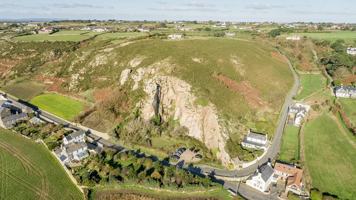
With the new threats of climate change and further urban developments- Geopark sites are heavily protected and are spread around the island, they include dolmens, heritage sites-such as Gronez Castle- and rocky outcrops. All sites are significant in Jersey’s heritage- with some sites dating back to over 6,000 years ago.
‘Global Geoparks are single, unified geographical areas where sites and landscapes of international geological significance are managed with a holistic concept of protection, education and sustainable development. A UNESCO Global Geopark uses its geological heritage, in connection with all other aspects of the area’s natural and cultural heritage, to enhance awareness and understanding of key issues facing society, such as using our Earth’s resources sustainably, mitigating the effects of climate change and reducing natural disasters-related risks. The purpose of a UNESCO Global Geopark is to explore, develop and celebrate the links between that geological heritage and all other aspects of the area’s natural, cultural and intangible heritages. It is about reconnecting human society at all levels to the planet we all call home and to celebrate how our planet and its 4,600 million year long history has shaped every aspect of our lives and our societies’. For Jersey, the intention is for the Geopark to extend across the Island and its territorial waters, including the offshore reefs.
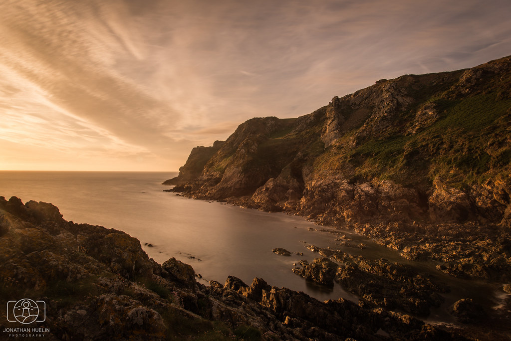
I plan to have my first photoshoot in the areas surrounding L’ Etacq, Le Pinacle and Stinky Bay which are all Geopark sites.
SCHOOL TRIP- GEOPARK VISITOR CENTRE
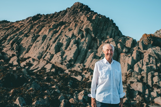
We attended a talk about Jersey’s geology which was conducted by Ralph Nichols, referencing places of interest to Jersey’s Geopark sites and places that would be good for photography.
Ralph Nichols – Geologist Société Jersiaise Lecturer, Teacher, Secretary for the Geology, Archaeology and Jèrriais Sections of Société Jersiaise.
The visitor centre displayed images of the various sites around Jersey, with information about their geology such as their mineral composition and rock type (metamorphic etc). Attention was also drawn towards the sound scape which as playing in the centre- which focused on ‘natural Jersey sounds’ such as birds singing, the sound of the sea and even Jersey’s own language- Jèrriais– which can be heard on this link.
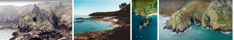
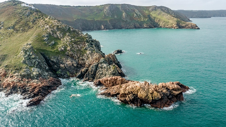
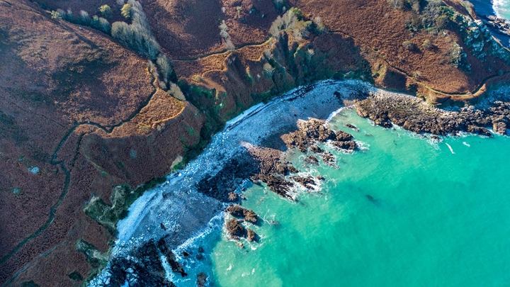
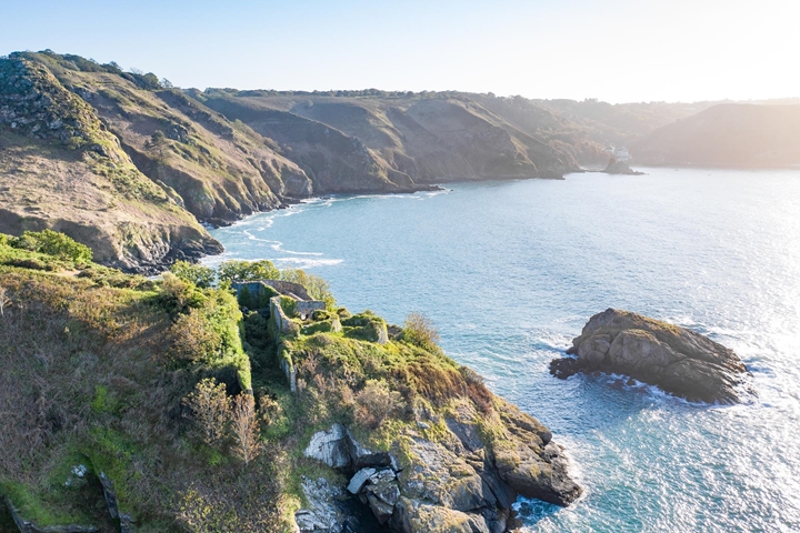
Four of Jersey’s Geopark locations; Caves on the North coast, Belcroute bay and Le Islet in Bouley Bay.
“UNESCO Global Geoparks are single, unified geographical areas where sites of intranational geological significance are managed with a holistic concept of protection, education and sustainable development”. There are 169 of there geoparks in 44 countries around the world. They carry geological heritage, tell us about the history, events and processes that formed it.
MINERALS OF JERSEY
Minerals are made from elements like silicon, oxygen, aluminium, iron and other metals. They are the fundamental building blocks of all rocks. As magma (molten rock) cools, minerals such as quartz and feldspar form crystals. The longer the cooling process takes, the larger the crystals. Minerals can also be carried through rocks by water, forming crystals as the water evaporates.
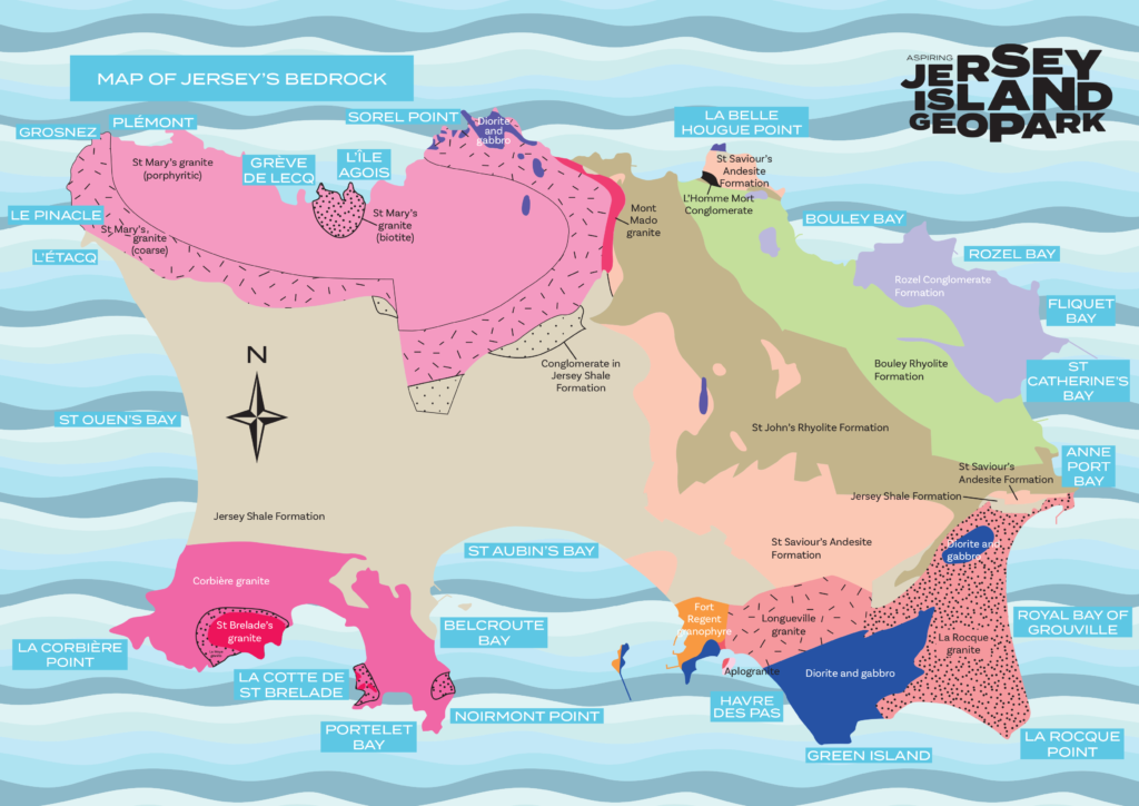
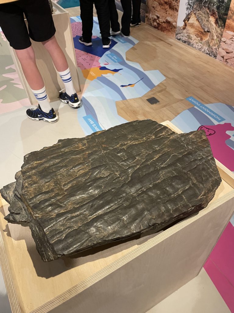
JERSEY SHALE FORMATION
The shales are the oldest rocks in the Island. You can see them in the west, across the centre and in the south of Jersey. They were formed by mud, silt and sand brought together on the sea floor about 600 million years ago. These sediments were transformed into rock by being pushed together, hardened and folded.
JERSEY VOLCANICS
Volcanic lavas and ashes can be seen along the north and northeast coasts of the Island. These andesites and rhyolites formed as a result of volcanic eruptions occurring 580 million years ago.
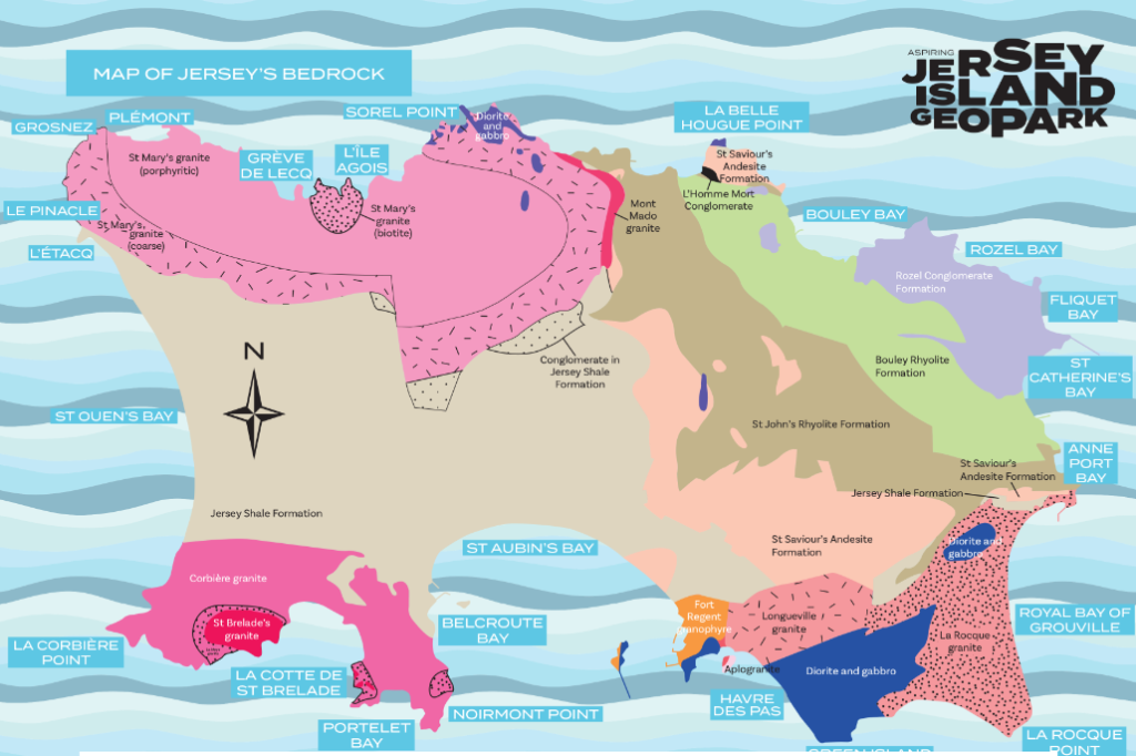
JERSEY GRANITES
Jersey is famous for its granites, which have been favoured as a building material for thousands of years. These major intrusive or ‘plutonic’ rocks were formed between 580 and 480 million years ago by molten rock cooling and solidifying between the Earth’s surface. They are only visible once the overlying rocks have been eroded away. The dark rocks known as gabbros are the oldest, and are rich in iron and magnesium. The true granites, visible along the northwest and southwest coasts, are lighter in colour, and consist of three main minerals: quartz, feldspar and mica. On the southeast coast, where granites have broken through the Earth’s surface into older gabbros, a mixed rock called diorite has formed.
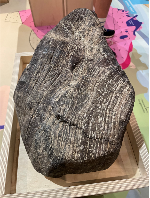
ROZEL CONGLOMERATE
Formation Conglomerate can be seen along the northeast of the Island and is made up of beds of pebbles which have been cemented together. They were formed around 400 million years ago and are the youngest hard rock formation in Jersey. Conglomerate is also known as ‘pudding stone’ because the rock formation is made up of lots of pebbles, probably from eroded and worn mountains. Streams with fast flowing water carried the pebbles and sand down valleys and left them behind before they cemented together.
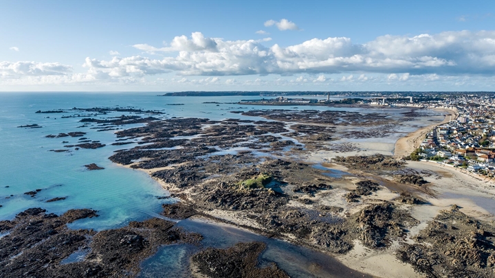
JERSEY’S OFFSHORE REEFS
Jersey is surrounded by offshore reefs bursting with marine life, Les Pierres de Lecq to the north, Les Écréhous to the northeast and Les Minquiers to the south. Local fisherman enjoy fishing around these reefs which often prove dangerous to larger ships.
HOW OLD IS THAT ROCK?
At low tide Les Minquiers reef is bigger than Jersey. On this large reef, the rock is mostly made up of types of granite. These granites have features older than the Jersey granites. Could this mean that Les Minquiers reef is older than Jersey?
SEA LEVELS AND CLIMATE CHANGE
The world’s climate fluctuates as a result of changes in the sun’s activity affecting the polar ice caps, the dome-shaped sheets of ice found in Greenland and Antarctica. These effects occur gradually over time, making sea levels change as ice caps melt or cool. This cycle of cold and warm periods has repeated itself several times over the past two million years. Since 10,000 years ago, sea levels have risen to make Jersey an Island once more.
GLACIAL
In a cold period, global temperature becomes cooler causing the ice caps to grow. This traps much of the world’s water, causing sea levels to drop as much as 200 metres. Just imagine the English Channel disappearing with Jersey and Guernsey as only hills in a vast coastal plain.
INTERGLACIAL
In a warm period, global temperature becomes warmer causing the ice caps to melt. Sea levels rise as freshwater is released back into the oceans. Evidence for past changes in sea level and the shifting of the Earth’s tectonic plates can be seen today in the many raised beaches in Jersey. The highest raised beach in the Island is at South Hill.
Jersey’s Geological Heritage – Sites of Special Interest (SSI)
Sites of special interest are places of zoological, ecological, botanical or geological significance. Jersey’s geology is very much different than that of the United Kingdom and other Chanel Islands. The States of Jersey has chosen 22 of the islands most important areas as Sites of Special Interest so that they can be protected from development for future research.
Written by Dr Ralph Nicholas and Samantha Blampied
This booklet introduces you to Jersey’s geological SSI, covering information about their location and basic descriptions and photographs which highlights each site’s significance defining features.
The Aspiring Jersey Island Geopark Visitor Centre presents the story of Jerseys geological heritage.
Geopark Ambassadors
Geopark Ambassadors represent some of the organisations working with Aspiring Jersey Island Geopark. One of the ambassadors is Ralph Nicolas, a Geologist Société Jersiaise Lecturer, Teacher, Secretary for the Geology, Archaeology and Jèrriais Sections of Société Jersiaise.
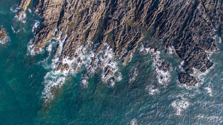
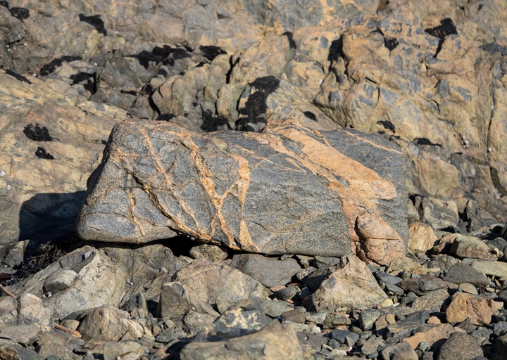
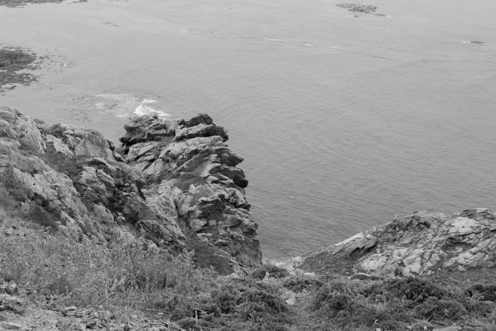
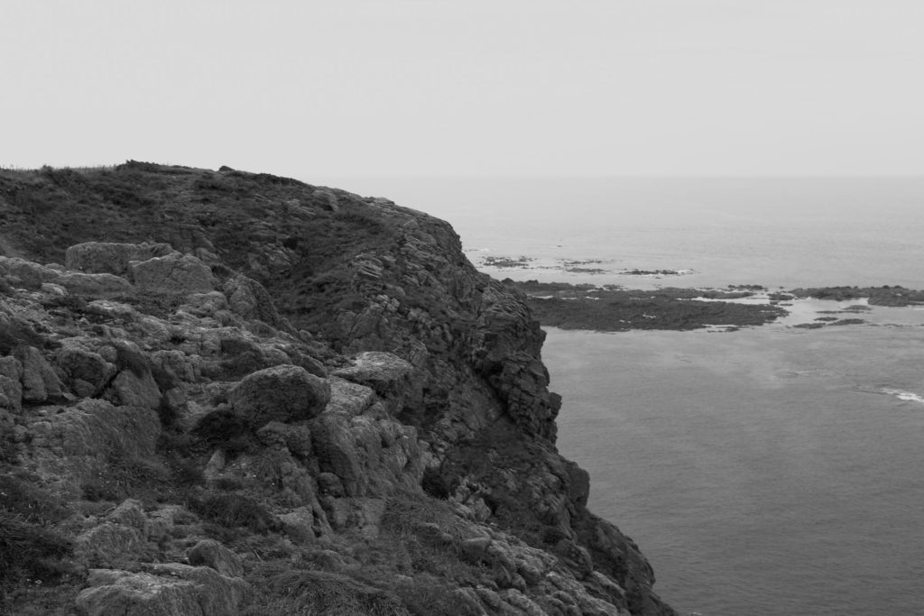
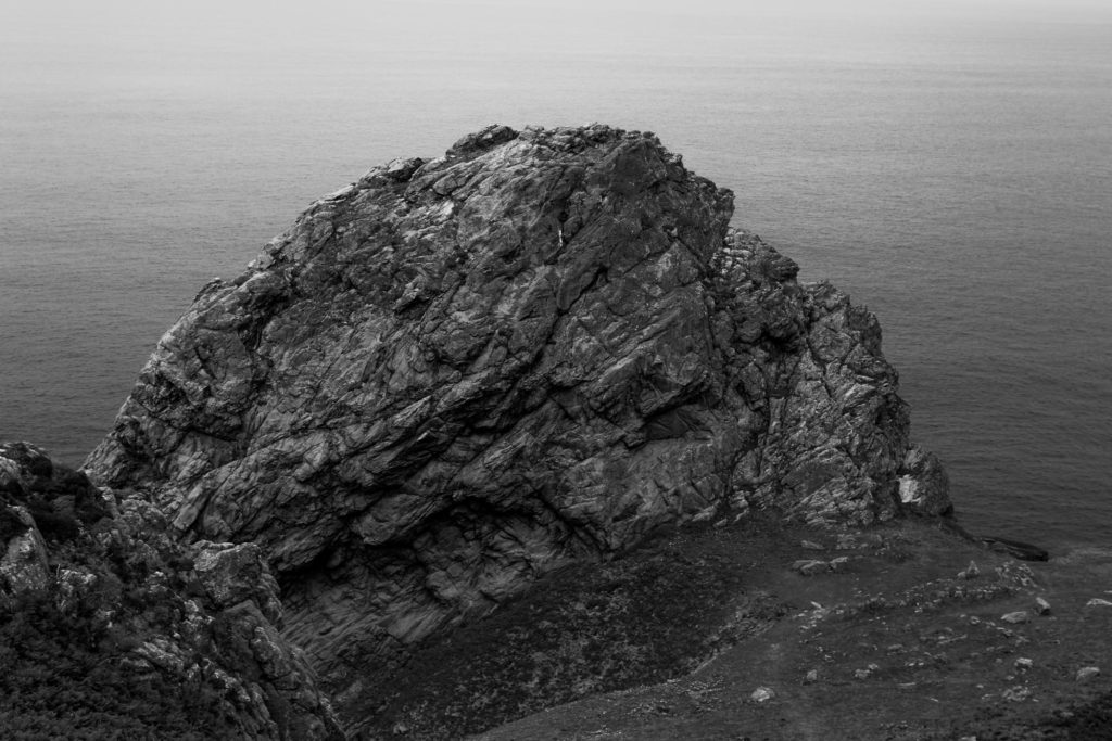
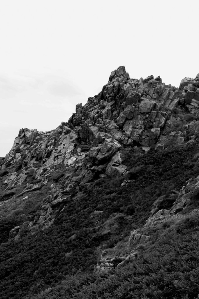
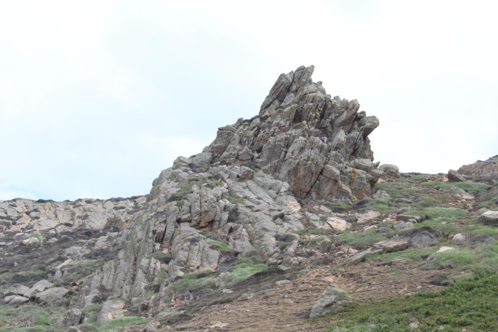
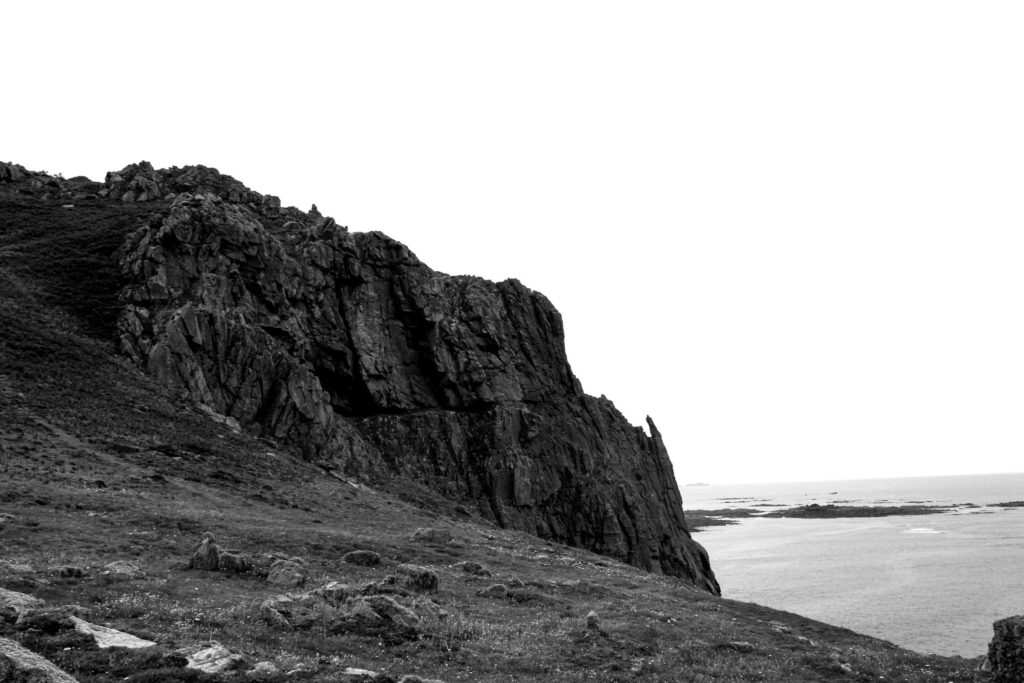
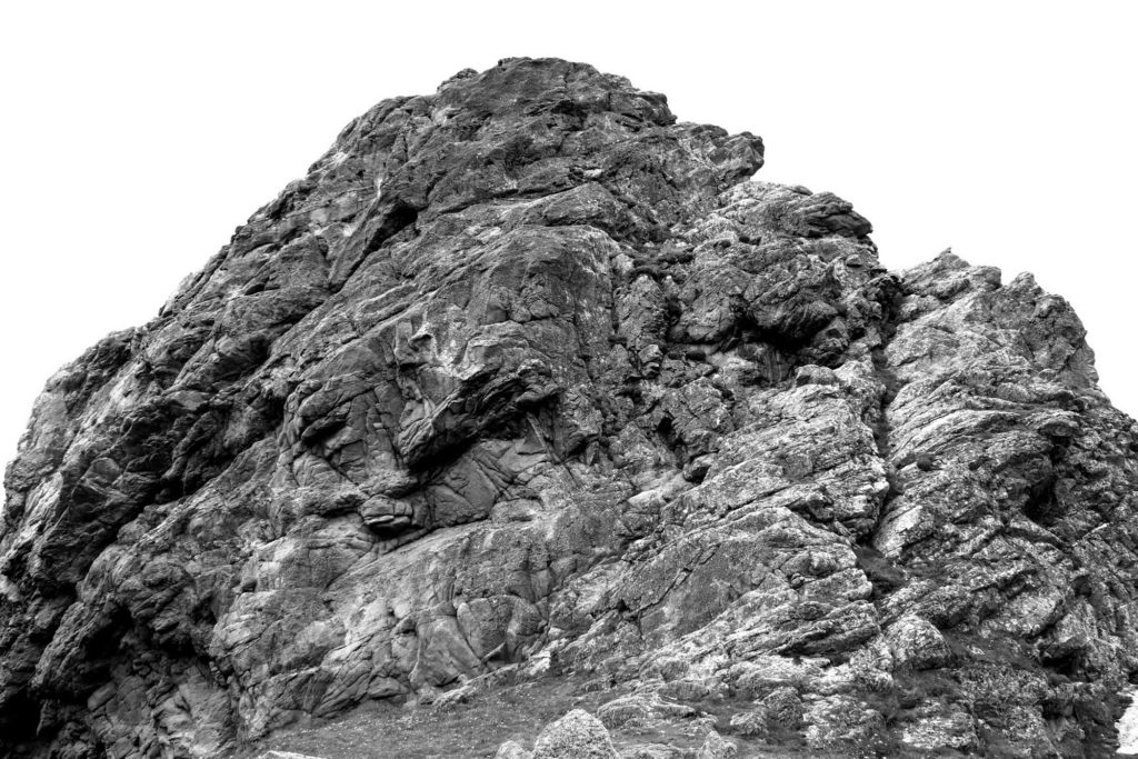
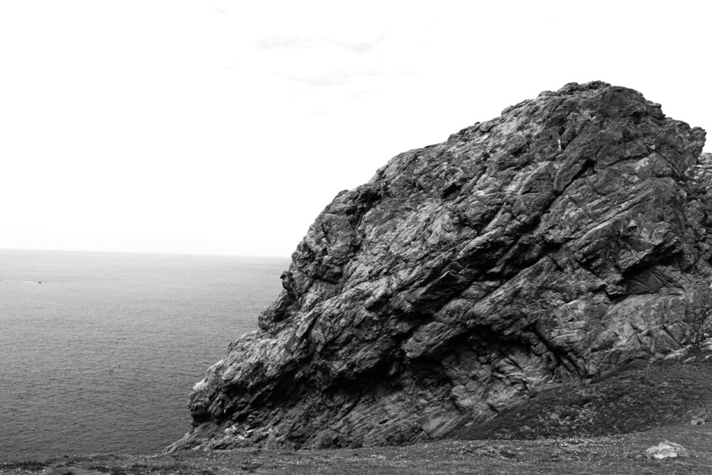
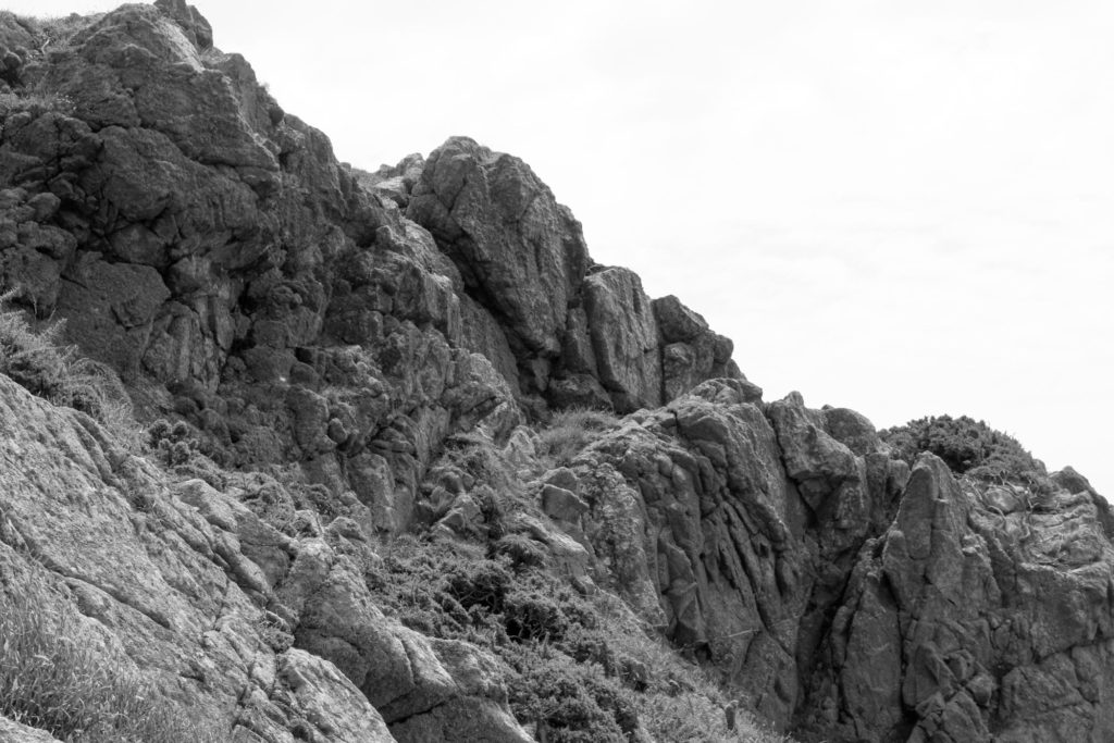
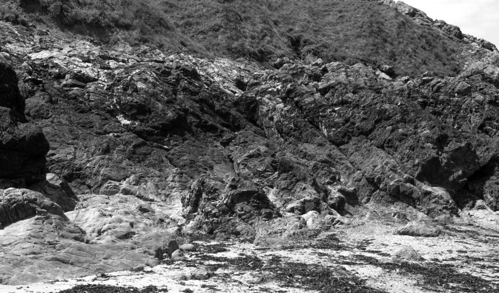
For my first photoshoot for my new topic ‘Islandness’ we went to the parish of St Ouen and walked around L’Etacq taking photos of interesting rock formations. We walked around the cliff paths trying to capture any rocks that seemed unique to take back to class and edit. Also, I took a lot of images of the same rock formations to try attempt to create David Hockney’s ‘Joiners’. Overall, I managed to take around 300 images when on the St Ouen photography trip.
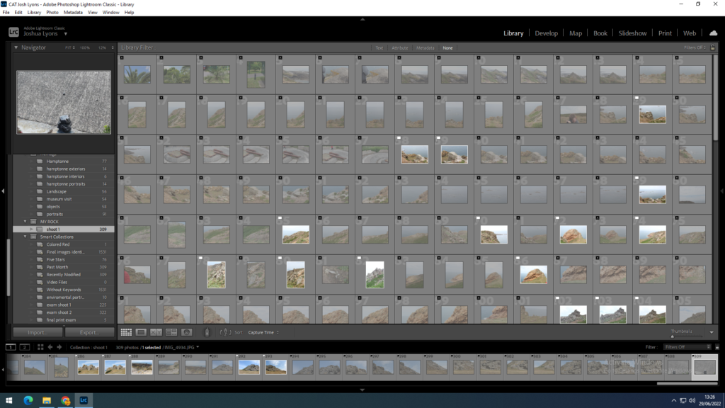
Contact sheets
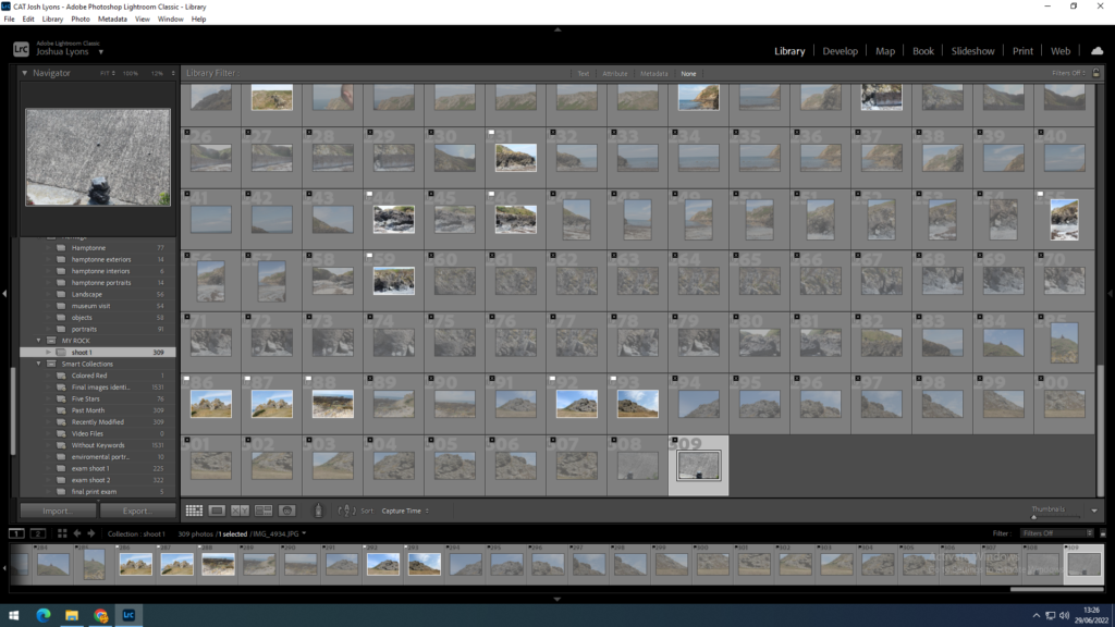
the first thing I did with this photoshoot is upload the images into Lightroom into a new collection called MY ROCK. I then used the flagging system to select the best images out of the 309 from the shoot, this left me with 60 images as a lot of the images came out blurry or were just not very good.
flagged photos in photoshoot
flagged photos in photoshoot
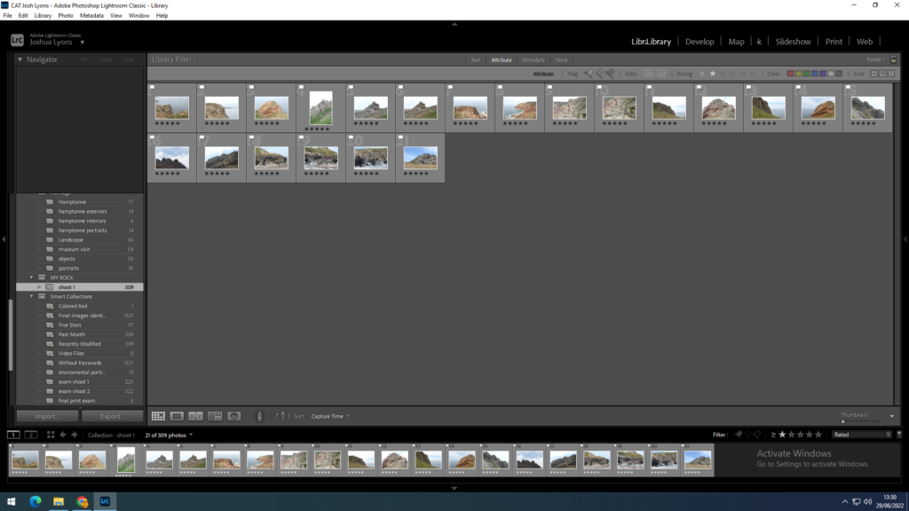
I then used the star rating system to select the best images out of the flagged images to use for editing and for my final images. After using the rating system I was left with 21 final images I could use for editing and selecting as my final outcomes.
final images
Lightroom edits
I decided to create most of the edits in black and white, this is because I think it looks a lot more effective and dramatic compared to the coloured images of the rocks and landscape.
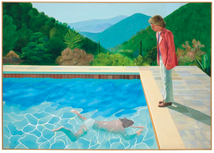
David Hockney is a British painter and photographer known for his ‘joiners’, an experimental style of photomontage that combines an array of images across time, space, and viewpoints.
Time– The time it takes Hockney to take all of the images, the time between the images taken, the time it takes for the images to be developed, the time it takes Hockney to construct the joiner, the time between it being completed and the viewer seeing it, the amount of time the viewer spends looking at it.
Space– Hockney is able to alter the perception of space by changing the angles and sizes of the images, creating a completely different environment.
Viewpoints– By changing the time and space of the images, he also changes viewpoints and perspectives, showing the subject from in various ways within one final image.
David Hockney (born 9 July 1937) is an English painter, draftsman, printmaker, stage designer, and photographer. As an important contributor to the pop art movement of the 1960s, he is considered one of the most influential British artists of the 20th century.
HOCKNEY’S JOINERS
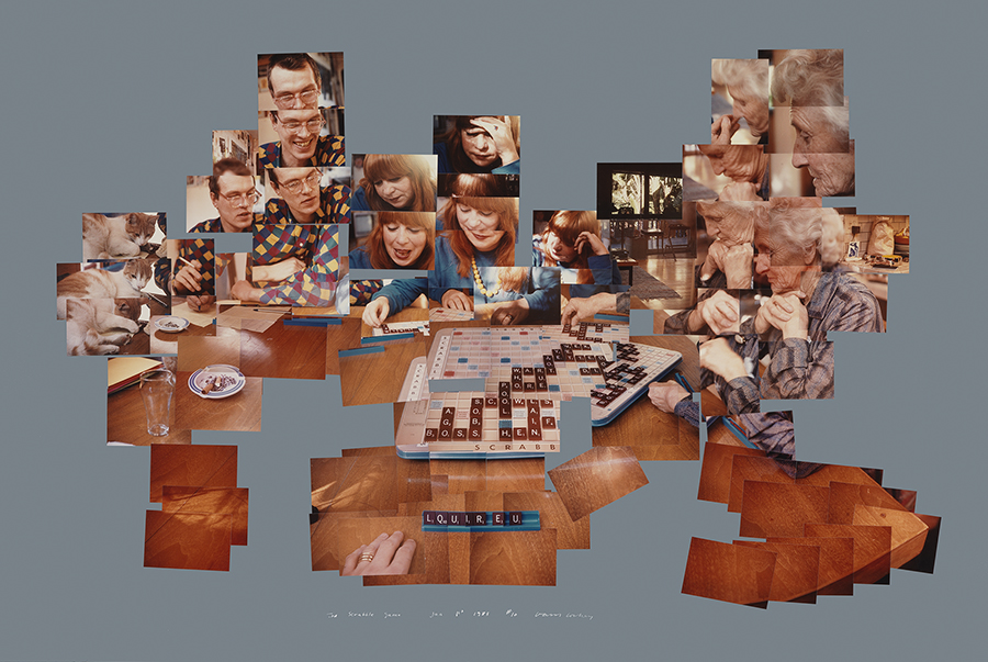
In the early 1980’s, Hockney began creating intricate photo collages that he called “joiners”. His earlier collages consisted of grid-like compositions made up of polaroid photographs.
Hockney created joiners was by taking multiple and varying Polaroid shots or photolab-prints of just an individual subject. Then with these shots he would arrange them into what almost looks like a patchwork, to create on overall image.
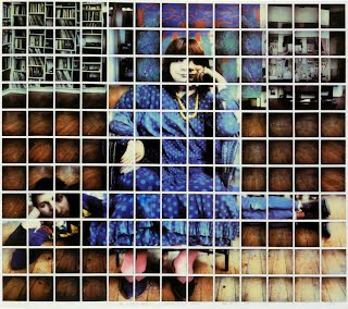
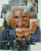
One of Hockney’s first ‘joiners’ was a photomontage of his own mother. Inspired by Cubism, Hockney created images where a 3-dimensional space was portrayed as a 2-dimensional image. Hockney’s joiners aimed to create an image that was able to show reality how we experience it (in fragments, not as a whole), and to show the passage of time.
David Hockney was famous for his unique style of photography. In the 1980s, he began making photograph collages and he use to call them, joiners. He used Polaroid photos and soon 35mm prints in color. Hockney cleverly composed a patchwork of images.
Interested in how 3-dimensional space can be portrayed in a 2-dimensional image. Joiners aimed to create an image that was able to show reality how we experience it (in fragments, not as a whole), and to show the passage of time.
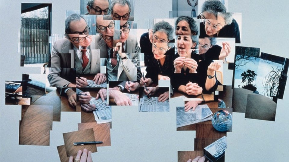
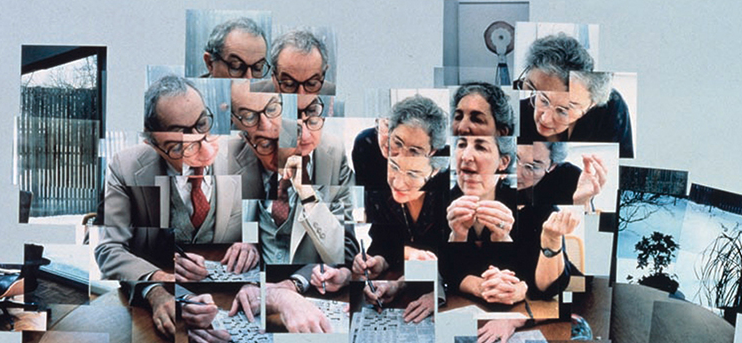
Image Analysis
This image is a joiner by David Hockney, the genre is documentary portraiture. The lighting in this image is natural outside lighting which projects shadows of the subjects. The focal point of this image is the pointing finger in the very middle which i circled in red. The Mice-en-scene of this image shows two middle aged men having some sort of discussion where they are pictures laughing and smiling, perhaps looking at something in the distance. This image is created by putting together many different polaroid images which Hockney calls a ‘joiner’. I believe Hockney’s joiners are so interesting as they are 2D images which emphasise movement and shape. Hockney’s joiners create a still video like image where you can easily understand the scene and act as a timeline.
A Geopark is defined as “a UNESCO-designated area containing one or more sites of particular geological importance, intended to conserve the geological heritage and promote public awareness of it, typically through tourism“. Jersey is an aspiring Geopark due to it’s large geological range, which differs from the UK and other Channel Islands. This also has a large impact to Jersey’s culture and history, making it a strong contender to become a Geopark.
Jersey has 22 SSI (Sites of Special Interest), all over the island. These places are important because of their cultural and geological significance, and have been protected by the government from development, so they can be viewed by the public and researched by professionals.
These sites include Le Pulec, Le Grand E’tacquerel, Le Petit E’tacqurel, and Le Pinnacle, which we visited on our field trip to St Ouen’s. They provided a range of different subject matter to photograph, from beautiful landscapes to interesting close-ups.
Natural Sites of Special Interest (SSIs) are places that are considered to be of public importance because of their special zoological, ecological, botanical or geological interest, or a combination of these and other special qualities. They’re also land and water that people consider to represent natural heritage in terms of their flora, animals and geology.
Natural SSIs are given legal protection as the best examples of this natural heritage and some areas are of international importance and the government has an added responsibility to maintain their quality.
Sites of Special Interest in Jersey:
Les Blanches Banques(better known as the sand dunes) – the sand dunes of St Ouen’s Bay are important for the diversity of wildlife
La Lande du Ouest (better known as Gorselands) – the heathlands connecting Le Corbière with Beauport
Les Landes de L’Est (better known as Les Landes) – on the north west corner of Jersey, the heathlands of Les Landes provide a valuable mosaic of habitats and open landscape
L’Ouaisne– this small site in St Brelade’s Bay is a haven for an amazing array of animals and plants
Portelet– situated above L’Ouaisne Common, Portelet Common offers an unrivalled coastal landscape
Noirmont– the sister reserve to Portelet, this headland is very popular and valuable for its ecological and historical wealth.
La Mare au Seigneur(St Ouen’s Pond) – a highly valuable wetland area for the varied and numerous waterfowl it attracts
St Ouen’s Bay coastal strip compartments (areas between the Five Mile Road and the sea wall – areas of the fore-dune which contain a number of rare species associated with salt marsh habitat
Le Petit Pré – a secluded woodland area in Trinity which surrounds a picturesque wet meadow
Rue des Près– a wetland area which is important for the wet meadows and low lying marsh
Grouville Marsh – a complex of habitats comprising wet meadows, marsh, fen, wet and dry woodland
Bouley Bay and Les Hurets– coastal heath and maritime cliff on the north coast of botanical and zoological interest
Mont Orgueil (Gorey Castle) – the ancient walls of this castle offer niches for rare species of animal and plant
South Hill Battery– the grasslands alongside Mount Bingham support a wide range of grassland plants and is unusual in a largely urban environment
UNESCO Global Geoparks are single, unified geographical areas where sites and landscapes of international geological significance are managed with a holistic concept of protection, education and sustainable development.
Their bottom-up approach of combining conservation with sustainable development while involving local communities is becoming increasingly popular.
UNESCO’s work with geoparks began in 2001 and at present, there are 177 UNESCO Global Geoparks in 46 countries.
‘The Bailiwick of Jersey – consisting of 120 sqkm of land and 2,455 sqkm of marine waters – is an ecosystem of interconnected habitats, species and processes. Biodiversity is the variety and diversity of life and species that exist within this ecosystem and is present everywhere in the Bailiwick – from the centre of Town out to the Island’s territorial limits. Geodiversity is the variety of geological, geomorphological and soil features, which play a fundamental role in sustaining biodiversity.’-Draft Bridging Island Plan
Born 9 July 1937, David Hockney is an English painter, draftsman, printmaker, stage designer, and photographer. As an important contributor to the pop art movement of the 1960s, he is considered one of the most influential British artists of the 20th century. He studied at the Bradford College of Art (1953–57) and the Royal College of Art, London (1959–62), where he received a gold medal in the graduate competition.
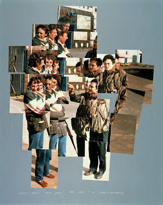
Hockney’s Joiners
In the 1980’s, Hockney began to create ‘joiners’, now they are photocollages. When he first began to produce these he did them with Polaroid prints and later on he did them with 35mm, commercially processed prints. How he created joiners was by taking multiple and varying Polaroid shots or photolab-prints of just an individual subject. Then with these shots he would arrange them into what almost looks like a patchwork, to create on overall image. One of Hockney’s first ‘joiners’ was a photomontage of his own mother.
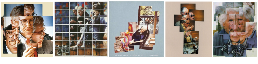
Examples of ‘joiners’
Hockney was very interested in how 3-dimensional space can be portrayed in a 2-dimensional image. Joiners aimed to create an image that was able to show reality how we experience it (in fragments, not as a whole), and to show the passage of time.
Image analysis
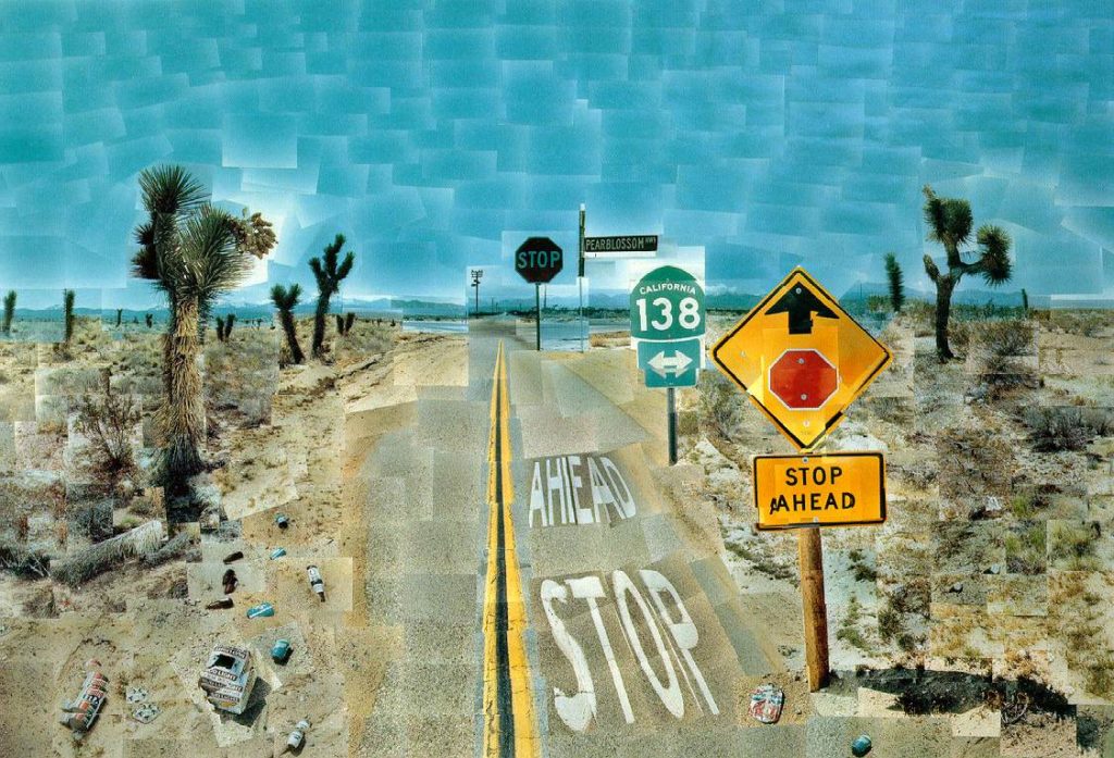
Pearl Blossom Highway 1986
In this image by Hockney you can clearly see the image is made up of over 100 different 2-dimensional quadrilaterals positioned in different angles and variations which all make up an image of Pearl Blossom Highway in California created in 1986. Hockney spent 3 weeks taking different shots of this certain part of the highway to create this image. The image displays a deserted road containing street signs and a few trees, with a heap of litter scattered around the beginning of the road. It shows good weather conditions that create a good effect contrasting between the blue sky and sandy roads. The images seems slightly distorted in a positive way by Hockney creating all objects and features not appear normal. The image nearly looks as if its is a painting, making it much more interesting and draws the eyes of viewers.