What is a Geopark?
A geopark is a unified area that advances the protection and use of geological heritage in a sustainable way and promotes the economic well-being of the people who live there. There are global geoparks and national geoparks. UNESCO Geoparks are territories presenting a unique geological heritage of international value. They are places where thoughtful visitors can meet, experience and touch the “Memory of the Earth”. The 4,5 billion years of history of our living planet. Geoparks are also places with an exceptional natural heritage. Fascinating landscapes, varied ecosystems, and significant biodiversity are valued there and allow visitors to understand the current challenges of our planet. The intangible heritage is the precious witness to the long and intimate relationship between the local population and the Earth. Today extremely threatened, its conservation and transmission constitute an important mission of the Geoparks.
UNESCO’s work with geoparks began in 2001. In 2004, 17 European and 8 Chinese geoparks came together at UNESCO headquarters in Paris to form the Global Geoparks Network (GGN)where national geological heritage initiatives contribute to and benefit from their membership in a global exchange network and cooperation.
On 17 November 2015, the 195 Member States of UNESCO ratified the creation of a new label, the UNESCO Global Geoparks, during the 38th General Conference of the Organisation. This expresses governmental recognition of the importance of managing outstanding geological sites and landscapes in a holistic manner. The Organization supports Member States’ efforts to establish UNESCO Global Geoparks all around the world, in close collaboration with the Global Geoparks Network.
Geoparks can be considered for multiple reasons, including:
- They are considered to be wildlife havens, meaning the animals that live there are undisturbed and protected
- They can be used as natural laboratories, which provide a site for experiments and research on nature
- They can be used as educational resources, allowing students from many subjects (history, geography, science(s), photography, etc…)
Jersey Geopark
jersey is a strong contender for this special designation because of our Island’s exceptional geology and our important cultural heritage which forms the outstanding surroundings we enjoy every day. Whether exploring Jersey’s diverse landscapes or seascapes there are lots to discover and inspire you.
Jersey’s Geological Heritage – Sites of Special Interest (SSI)
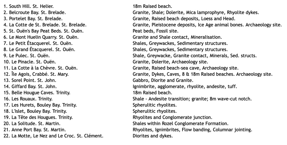
The Island of Jersey has geology that is significantly different to that of the United Kingdom and even from that of the other Channel Islands. Many of the island’s geological sites are of regional and international significance and some have attracted global attention.
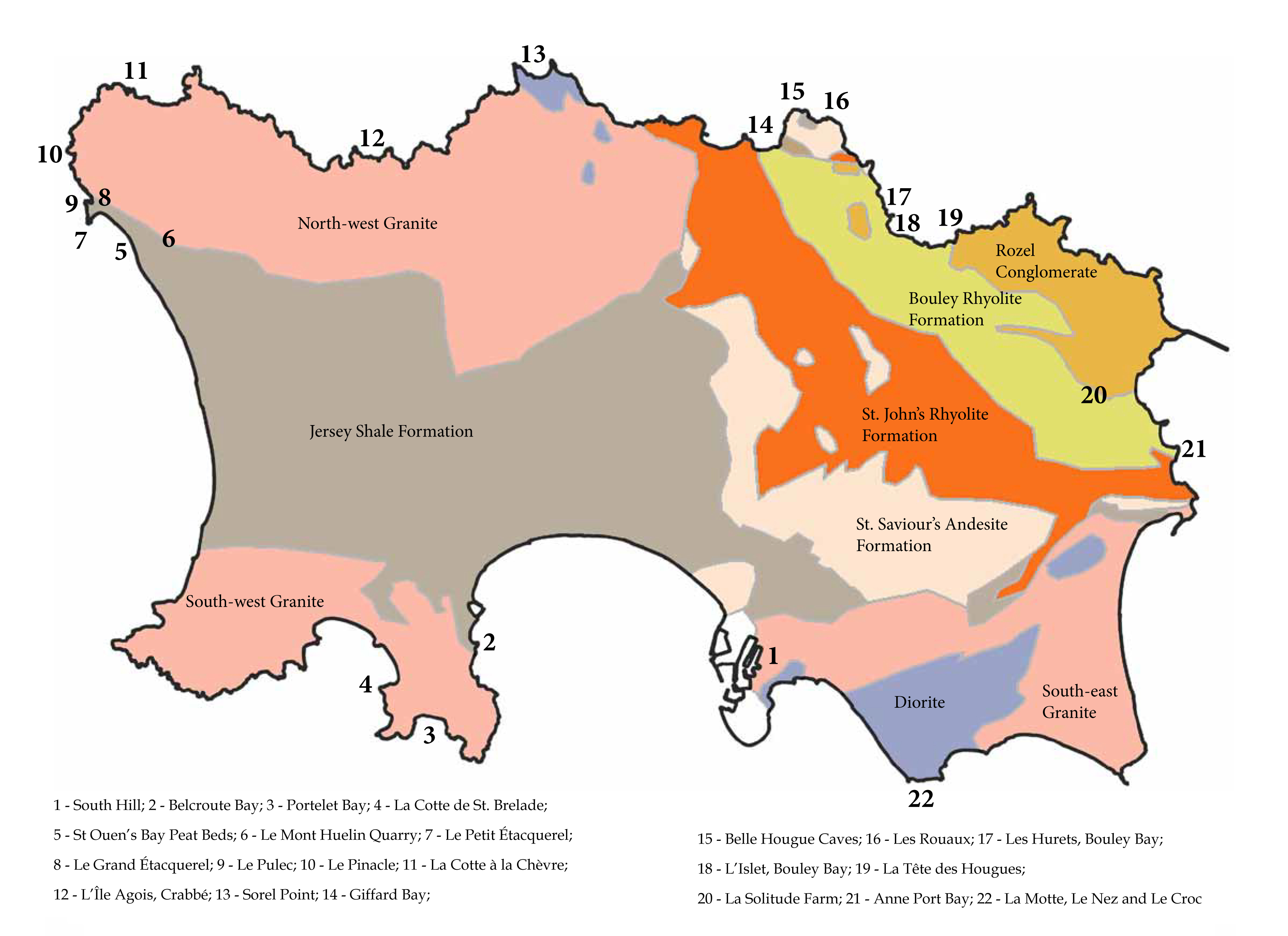
In recognition of this, the States of Jersey has designated 22 of the island’s most important outcrops as Sites of Special Interest (SSIs) so that they may be protected from development and preserved for future public enjoyment and research purposes. All the Island’s geological SSIs are covered here along with information about their location plus basic descriptions and photographs which highlight each site’s significance and its salient features.
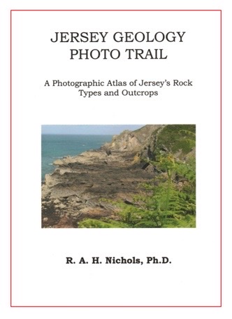
The Jersey Geology Trail
The Jersey Geology Trail, around Jersey in the Channel Islands, GB, reveals a remarkable variety of rock types and structures exposed in Jersey. The beauty of Jersey lies in its cliffs, bays and inland valleys. This beauty is the result of the island’s geology, the colour and the different hardness and structure of the rocks, and their response to the changes in climate over the years.
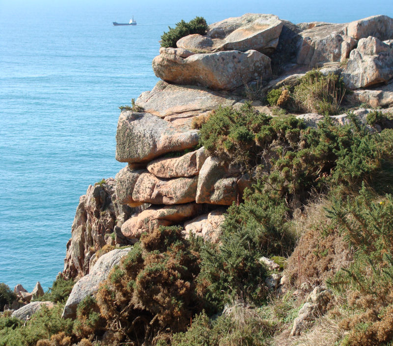
The Jersey Geology Trail is fascinating, with Precambrian to Lower Palaeozoic rock types varying from shales and sandstones, through andesites and minor basalts, flow-banded and spherulitic rhyolites and ignimbrites to flash-flood conglomerates. These are all folded and intruded by a variety of gabbros, diorites, and various striking pink granites, and a swarm of dolerite dykes plus lamprophyre, porphyritic felsite, rhyolite and various composite minor intrusives dykes and the odd sill. Metamorphic rocks also occur and range from contact metamorphic hornfelses to Green Schist Facies igneous rocks with various minerals easy to see. Finally, these are all overlain by various Pleistocene and Holocene loess, peat and forest, sand and head deposits seen around the coasts from shore to cliff top, in the valleys and marshes and in a fine dune system on the west coast.
Dr Ralph Nicols
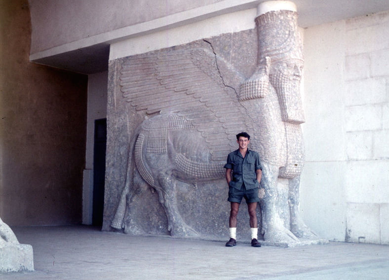
Your Jersey Geology Trail guide is Dr Ralph Nichols who graduated in Geology from U.C.W. Aberystwyth in 1958 after reading for the then-called triple crown of Geography, Geology and Economics. In the summer of 1957, He was awarded a study tour of the Kirkuk oilfield in Iraq which inspired him to study carbonate rocks. his lead in 1961, to being awarded a PhD for an interpretation and micro-fossil correlation of the depositional environments of the isolated outcrops of Carboniferous Limestone along the North Wales coast from SE Anglesey to the Great and Little Orme’s Heads and the Llanddulas outcrops.
In 1966, He moved to Canada to join a small research team with the Saskatchewan Department of Mineral Resources, responsible for part of the search for deep oil in the Devonian carbonates under the Prairies. I also became a Lecturer in Geology (in the ‘Extra-Mural’ Dept.) at the University of Saskatchewan, delivering a geology course for the Arts Faculty students who needed science to complete their degree.
He then returned to Jersey and became a teacher. He obtained a post teaching his hobbies – Geography, Geology and Outdoor Activities Later, He became Head of Humanities, which included Geography, History and Religious Education. He has also joined the Geology and Archaeology Sections of La Société Jersiaise and later helped to establish the Jèrriais Section, and also GCSE and A-Level Geology and Archaeology courses for night classes at Highlands College of Further Education. This enabled him to learn so much about this incredible island which has a greater variety of things natural and historical than he has ever found in such a small area.