Category Archives: Uncategorized

Filters

Author:
Category:

The FUTURE OF ST HELIER

Image result for FORT REGENT jersey

My Thoughts On St Helier

I feel that the government has been focusing on developing the finance industry at such a fast pace and forgetting about he needs of the average people who live and work in st helier as over time the amount of things to do especially for young people has become less and less with the removal of the skate park and the forget area which used to attract large amounts of crowds to St Helier, and the beach in st helier most  of the time is un-usable as it is covered in seaweed. As previously fort regent was full of different activities for young people to do and was easy to access by the cable cars that ran from the  center of town.  In my opinion I think that the future of of St Helier should be focused on bring all parts of the town up to the same standard of modernization as that of the fiance industries and that there should be more active centers and places for young people.

MasterPlan

A master plan is a dynamic long-term planning document that provides a conceptual layout to guide future growth and development. Master planning is about making the connection between buildings, social settings, and their surrounding environments. A master plan includes analysis, recommendations, and proposals for a site’s population, economy, housing, transportation, community facilities, and land use. It is based on public input, surveys, planning initiatives, existing development, physical characteristics, and social and economic conditions.

Master planning can assume some or all of these roles:

    • Develop a phasing and implementation schedule and identify priorities for action
    • Act as a framework for regeneration and attract private sector investment.
    • Conceptualize and shape the three-dimensional urban environment.
    • Define public, semiprivate, and private spaces and public amenities.
    • Determine the mix of uses and their physical relationship.
    • Engage the local community and act as builder of consensus.

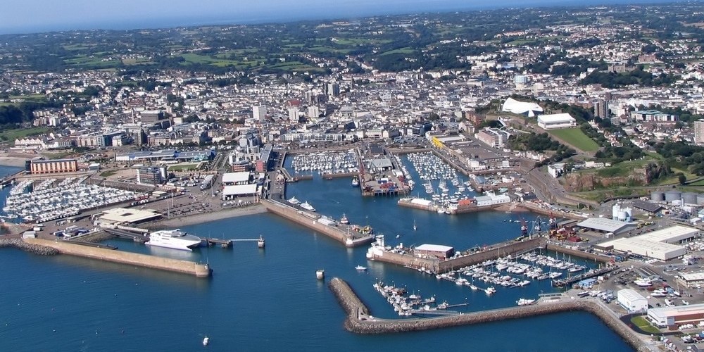
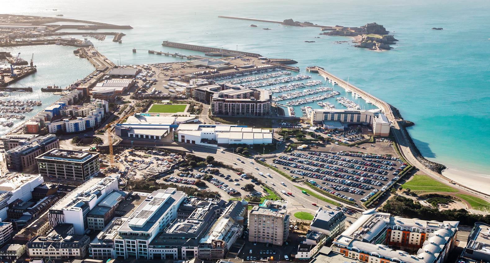
St Helier has always been the capital of the island and the main area of growth and development and where most of the isaldn money came from, throught the use of the ports and the incoming shiops. But the finance industy has now over taken this and is a rapid expanding area for growth, and is where most of the population comute to and from even though St helier on has around a population of about 33,500, roughly 34.2% of the total population.


Image result for finance centre jersey

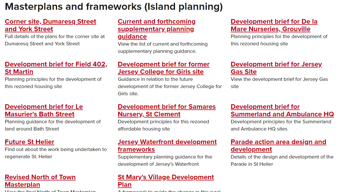
Image result for finance centre jerseyThere is a current MasterPlan for the Northside of the town to be re-developed to make the area more appealing and up to date with the current economy, this can be seen in the link below:                                      https://www.gov.je/SiteCollectionDocuments/Government%20and%20administration/R%20Revised%20North%20of%20Town%20Master%20Plan%20June%202011%20-%20Pages%201-9.pdf

My location for the shoot

History of St Helier

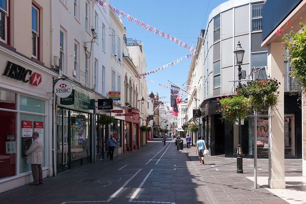
Saint Helier is the capital of the twelve parishes of Jersey,  St Helier has a population of about 33,500, roughly 34.2% of the total population of Jersey. The urban area of the parish of St Helier makes up most of the largest town in Jersey, although some of the town area is situated in adjacent St Saviour, with suburbs sprawling into St Lawrence and St Clement. The larger part of St Helier is rural and the town being the mian built up area.

In the second half of the 19th century, hundreds of trucks laden with potatoes and other export produce needed access to the harbour. This prompted a programme of road-widening which swept away many of the ancient buildings of the town centre. Pressure for redevelopment has meant that very few buildings remain in urban St Helier which date to before the 19th century, giving the town primarily a Regency or Victorian character.

My area of focus

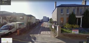
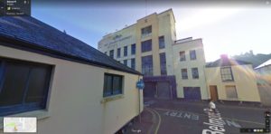
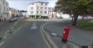
For this project I am focusing on two different area of town the Prade/Cheapside area and the I live in the Cheapside area of town ( which is clouded in purple on the map). As i have grown up there i feel that i have a close connection to this area and, by knowing many of the locals in this area for most of my life I think that I will be able to capture a sense of the community in this area. Cheapside is one of the more diverse area of St Helier as most of the Portuguese community in Jersey have small cafes there which everybody is welcome to come too. Also growing up in this area, and exploring the area as a child I know many little  spots that would go unnoticed by the passing eye. But i am also going to focus on the north-side of town as this was the area given to me, as the north of st Helier has been left behind in modern day improvements and developments, so I am going to focus on the aspect that parts of the area have been left to become derelict and have not much use of function. And that is has a master plan to rented to become like other parts of st Helier, i want to capture it in its modern state which, which is stuck in the past I feel that this area has a lack of community as this area is mainly used by people commute in and out of the area as five of the main secondary school are located on this area. So my plan for the north side of town is to focus on Buildings, the current state that they are in, the architecture, how they have been left, and to focus on the sense of community in the cheap side area and the rural aspects that have manged to survive.

Areas Of Interest On The Day

Percival Dunham – Photographer Research

Percival Dunham was Jersey’s first photojournalist, for a short two years in 1913 and 1914. During these two years of photojournalism Dunham worked for two local newspapers, Illustrated Weekly and then the Morning News. These newspapers were the Island’s main competitors for the now Jersey Evening Post, which is now the islands only daily newspaper and has been since 1959 following the closure of  the French language newspaper Les Chroniques de Jersey. In time closely leading up to World War 1, the Jersey Evening Post hadn’t looked into alternative and new ways of including photographs in their newspapers, however the Illustrated Weekly and Morning News had and were therefore the pioneers of photojournalism on the island.
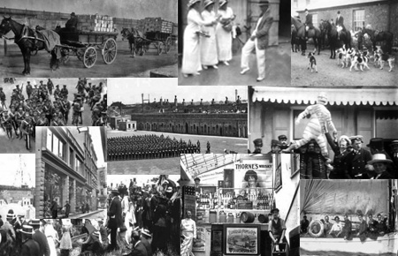
over 1,000 of his images are in the collection of La Societe Jersaise, a selection of these photographs can be viewed on the archive website, here is a link to this page… http://photographic-archive.societe-jersiaise.org/brief.aspx

Here is one of Dunham’s photographs that particularly stood out to me, so I have decided to analyse…
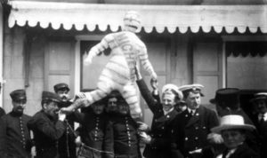
Technical – This photograph has quite a balanced depth of field as there isn’t much depth within the subjects of the photograph, meaning that all elements of the photograph are in focus, I am also presuming that from the outdoor setting that the photograph was taken using natural light.

Contextual – The photo is titled ‘publicity stunt for Michelin’ which is a well-known French organisation. As this photo would’ve been taken during Dunham’s two years of photojournalism for local newspapers, it would’ve been taken in either 1913 or 1914 in the years leading up to the Second World War in Jersey. 

Visual – The photo has a slightly high contrast which allows for the individuals’ uniforms to stand out from the background. The subjects in the photo seem to know that they are having their photo taken which in this instance is quite effective as they are making eye contact with the camera. Evidently the photo is black and white, which visually implies that the photo was taken quite a while ago. The main visual focus of the photo is the Michelin man figure, without this I personally believe that the photo would be a lot less visually interesting.

3. Brief History of St. Helier

Gaul was a region of Western Europe during the Iron Age that was inhabited by Celtic tribes this included jersey. The area which we now call St Helier was first used as a fishing village on the dunes between the marshy land behind and the high-water mark. The parish church was built on the water front  in the 12th century where boats were tied to the walls surrounding it, now due to the reclaimed land sits a lot further in land. Elizabeth Castle was built in the early 1600’s due to Mont Orgueil no longer being sufficient for the cannons being used to defend the island and town.

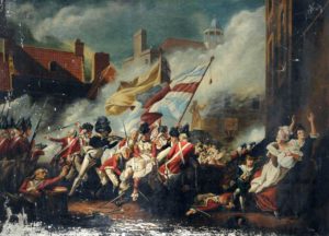
18th Century: The town consisted of mainly houses, shops and warehouses along the coast and surrounding the church and market (Royal square from 1751). £200 was given by George II  towards the construction of a new harbour, before this boats beached themselves on a low tide and good were transported over the beaches to hard land. In 1781 the royal square was home to The Battle of Jersey, a scene from this event is captured in the famous painting by John Singleton Copley‘s

Copley, John Singleton; The Battle of Jersey; Victoria College, Jersey; http://www.artuk.org/artworks/the-battle-of-jersey-137676

19th Century: Roads built for military purposes made it possible for farmers to transport their goods from farms to the fast sailing ships and later steamships in St. Helier and then on to Paris and London, this was the start of Jersey’s success in agriculture. In 1820 there was an increase in english speaking people moving to live in Jersey due to the end of the conflict with France, better communication and transport. During the second half of the 19th century roads were widened to allow trucks filled with produces to access the harbour, many ancient buildings were demolished in the town centre for this. Very few building remain in St. Helier from before the 19th century giving the town a victorian character.

20th Century: A tunnel road was built under Fort Regent in the 1960s allowing traffic to avoid the steep hill from the east side of town around the harbour. at this time fort regent was also in the 1960s, income from the developed into a leisure facility which had a cable car to connect it to the town centre. King Street was made into a pedestrian friendly road in the 1970’s as more high street shops moved to the island. Fort Regent leisure centre was later closed in the 90’s.


2. Masterplan

masterplan is a long-term planning document that shows a conceptual layout to guide future growth and development of an area. Master planning is about making the connection between buildings, social settings, and their surrounding environments. A master plan includes analysis, recommendations, and proposals for a site’s population, economy, housing, transportation, community facilities, and land use. It is based on public input, surveys, planning initiatives, existing development, physical characteristics, and social and economic conditions. The changes are normally long-term and can be altered based on changing conditions over time.

Already masterplans have been used the the development of St. Helier in the reservation of the Weighbridge into Liberty Wharf shopping centre and in the current finance centre which is under development. Previous to this a lot of land was reclaimed from the sea and made into the water front, this was a huge project which would of used the process of masterplanning to achieve the best result possible. Master

Link to official Masterplan for the development of the North of St Helier https://www.gov.je/Government/Pages/StatesReports.aspx?ReportID=583

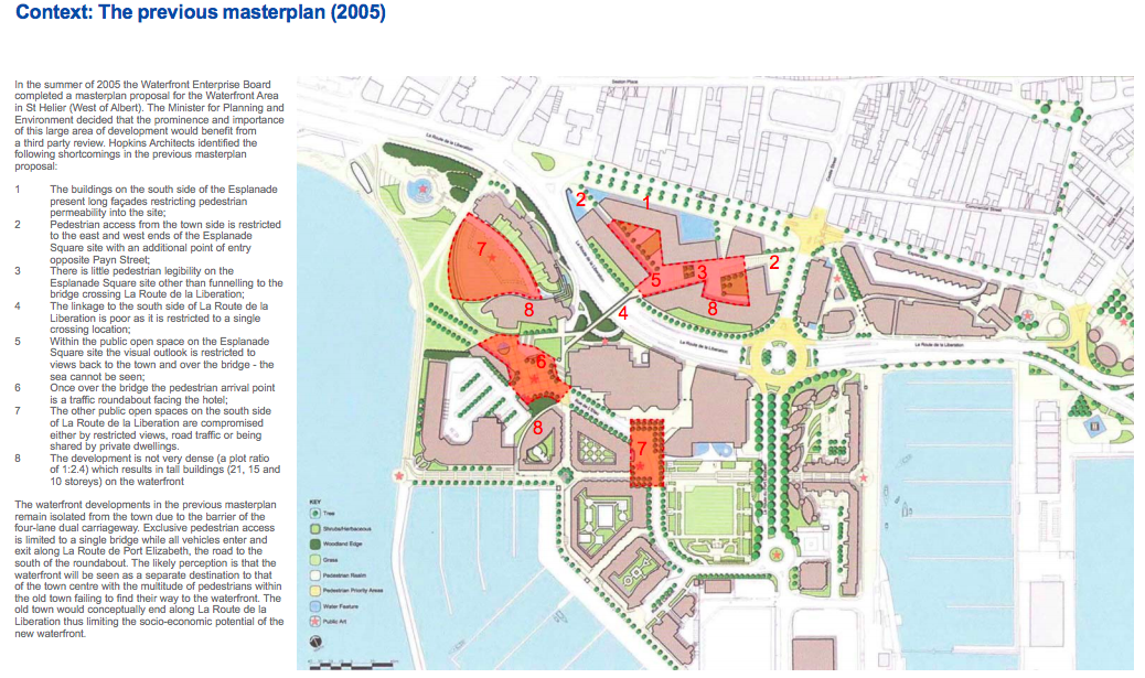
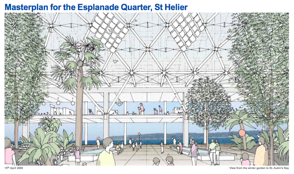
Links to Masterplan for the Esplanade Quarter. https://www.gov.je/Government/Pages/StatesReports.aspx?reportid=137

1. my views on the future of St Helier

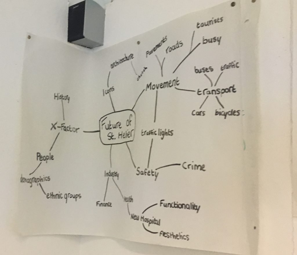
Describe your own view, feelings and vision for how you see the Future of St. Helier?

I do not live in or near St Helier which means when I do go town it is for a specific reason such as shopping, leisure or as a connection point for transport. Currently I think st helier is a well developed part of the island which provides facilities for all the people who live work and visit there, I also think it is full of tradition and although it has been constantly evolving ever since the war there are still key features which have always been the same. After listening to the plans on the development of the water front including the finance centre I feel that the heart and sole of the island is slowly being taken away. The two new buildings on castle street look very modern and help to bring life to this area of town however I think the buildings look like any other city building and lack personality connecting them to the unique island. Jersey will never have a big city due to it’s size, so I don’t think the architecture should make it out to be something that it is not. On the other hand I also think that if jersey is going to be developed further and be built up in more areas there are ways space can be saved and the landscape can be made more interesting at the same time. There is currently a limit to the height of buildings in town which makes the skyline look very flat and boring, if permission could be granted to build up instead of out on some buildings it could ultimately save space town.

I also think St Helier needs to improve and change its rules on transport, due to the high concentration of people who commute around and through the town area, the traffic is becoming worse and worse. I think for such a small area there could be a much more efficient transport system which could work for everyone. In large cities such as London the traffic is limited when going through the city centre to reduce cramming and pollution in built up areas. This is done through a toll gate where vehicles pay to enter, a similar system could be used to prevent traffic in jersey as well as public transport such busses being made even more accessible from all parts of the island.

High rent for homes and shops is making it hard for independent businesses which give St Helier is Uniqueness to stay open, if these prices cary n going up we are going to see more and more chain companies and shops replacing them making town look like a clone of main land city.

Future Of St Helier

My Opinion and Views

I moved to Jersey 3 years ago from Brighton, England.

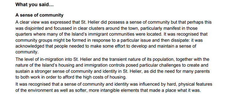
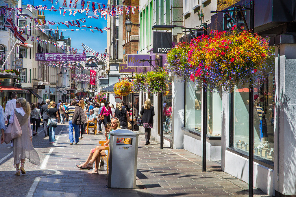
My first impressions of St. Helier were very positive as the town was much calmer than what I was used to in Brighton; It felt alive but at a much smaller scale – the amount of people, shops and attraction is much less but that doesn’t seem to affect the atmosphere or community.

Compared to Brighton there is a bigger variety of culture in St.Helier, however, it is not as visible and prominent. Brighton is very proud and honoured of its society and does its best to celebrate the diversity in whatever way possible – ranging from carnivals to displays and local holidays.

Personally, I don’t have any strongly negative or positive views of St. Helier, I’m on the fence in a sense, I can see St Helier for its beautiful and fulfilling community as well as its more negative sides. I’m hoping this project will help me establish a more concrete understanding and view of the capital.

Masterplan

Generally, a Masterplan is a high level plan with set objectives and strategies to help develop an area over time. It can also be a document that outlines rules and guidance that must be followed when building in a particular area.

It aims to define what is important about a place and how its character can be conserved, improved and enhanced. There is currently multiple documents that contain the masterplan of North of St Helier. These can be found on the Gov.je website.

What Masterplans provide is an outline of what areas must be protected completely and what areas can be altered. This is usually decided by a group of high ups who specialise and care about the future of St. Helier.  What the masterplans above show is the development plans for all the different areas of St. Helier. The future of St. Helier is the one that made me the most curious. The masterplan strives to expand and provide new housing for the growing population as well as supporting the already living population and meeting their needs and expectations.

Furthermore, the masterplan recognises the issues and challenges it will face in order to secure a steady growth in the future. It showcases the multiple workshops that have been held to interact and create a positive relationship with the public. There are multiple documents linked on the page that summarise each workshop, showing the key points and ideas obtained.

Link to Future Of St Helier Masterplan


The Future Of St Helier / What Is A Masterplan

According to definition a masterplan is a comprehensive plan of action. It is a look into the future plans of a certain area such as a town, city, country or island, in this case Saint Helier in Jersey, and how this specific place can be improved and worked upon in order to make it a better place for its people.

In this specific case looking at the masterplan revolving around the future of the parish physical advancements and work is currently being done such as the construction of Jersey’s new international finance centre and the construction of new accommodation complexes on the waterfront, amongst many other changes. Two main areas of Saint Helier that are currently being looked at specifically above others are The Waterfront and Gas Place, these two areas are undergoing intense planning in the near future, as I said before amongst various other aspects of the ‘Masterplan.’

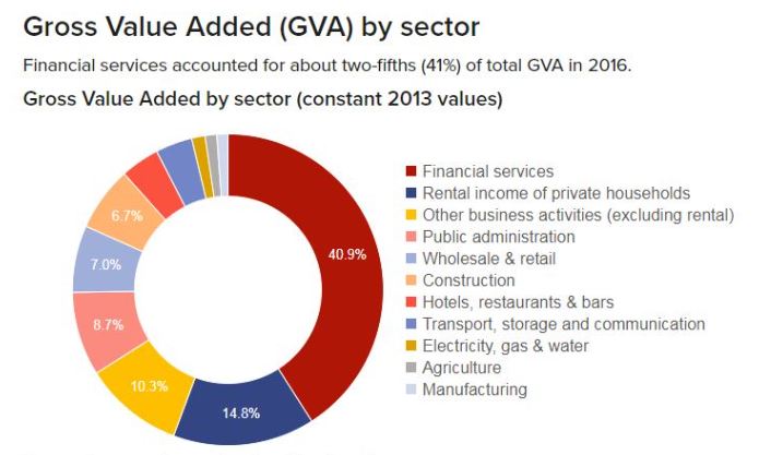
The development of the new international finance centre is very significant to the future developments that are occurring in St Helier, due to the rapid growth in the finance industry, specifically on the island. Here are some sector statistics from 2016 which show the true extent to which the finance sector is becoming so significant locally…

Overall my views on the future of St Helier, as someone who has lived in the parish my whole life and works in the town of St Helier, are that I am very unsure and intrigued to see how the changes implemented over the years to come will develop the parish either in a positive or negative way, as in some ways I believe that the parish is moving forward in a good way but in other ways it could definitely be approached in an alternative nature. And most importantly of all how it will affect the people of St Helier.

History Of ST Helier

18th century

Until the end of the 18th century, the town consisted chiefly of a string of houses, shops and warehouses stretching along the coastal dunes either side of the Church of St Helier and the adjacent marketplaceThe Royal Square was also the scene of the Battle of Jersey on 6 January 1781, the last attempt by French forces to seize Jersey. George II gave £200 towards the construction of a new harbour – previously boats would be beached on a falling tide and unloaded by cart across the sand.

19th century

Military roads linking coastal defences around the island with St Helier harbour allowed farmers to exploit Jersey’s temperate micro-climate and use new fast sailing ships and then steamships to get their produce to the markets of London and Paris before the competition. This was the start of Jersey’s agricultural prosperity in the 19th century.

20th Century

In the 1960s, income from the Jersey States Lottery was used to excavate a two-lane road tunnel under Fort Regent, enabling traffic from the harbour to the east coast towns to avoid a torturous route around the fort. About the same time, the Fort was converted into a major leisure facility and was linked to the town centre by a gondola cableway – closed and demolished in the 1990s.

21th Century

Liberation Square is now a focal point in the town – the former terminus of the Jersey Railway housed the Jersey Tourism office until 2007