Psycho-geography is a hybrid of photography and geography that emphasizes playfulness and “drifting” around urban environments. It has links to the Situationist International.
Psychogeography was defined in 1955 by Guy Debord as “the study of the precise laws and specific effects of the geographical environment, consciously organized or not, on the emotions and behavior of individuals.”
Another definition is “a whole toy box full of playful, inventive strategies for exploring cities… just about anything that takes pedestrians off their predictable paths and jolts them into a new awareness of the urban landscape
The originator of what became known as unitary urbanism, psychogeography, and the dérive was Ivan Chtcheglov, in his highly influential 1953 essay “Formulaire pour un urbanisme nouveau” (“Formulary for a New Urbanism”).
It has roots in Dadaism and Surrealism.
The idea of urban wandering relates to the older concept of the flâneur, theorized by Charles Baudelaire…and is similar to STREET PHOTOGRAPHY
PETAPIXEL definition of PsychoGeography CLICK HERE

What will you see on your journey…and how will you respond and adapt to it ???
Koyaanisqati : Drawing its title from the Hopi word meaning “life out of balance,” this renowned documentary reveals how humanity has grown apart from nature. Featuring extensive footage of natural landscapes and elemental forces, the film gives way to many scenes of modern civilization and technology.
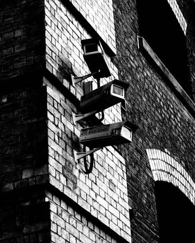
Superflux : explore over-surveillance and the prospect of intrusion in our everyday lives…has the concept of psycho-geographies evolved into something dystopian-like and Orwellian (1984- “Big brother”)…governments, town planners and the authorities design how we live, where we live and essentially control popluations of towns and cities.
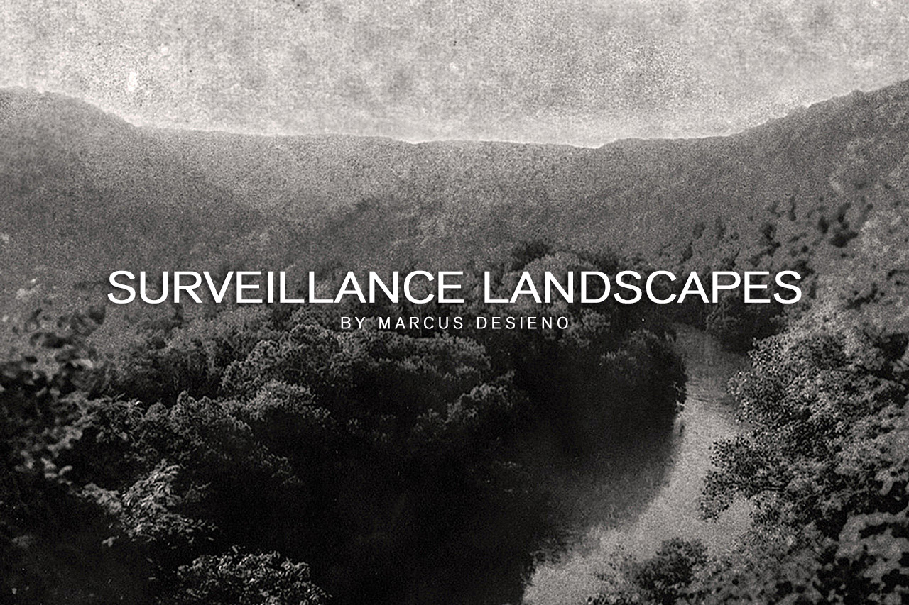
Marcus Desieno creates de-humanised landscape photography by hacking surveillance camera networks…but avoids privacy problems normally associated with urban and residential areas…
What you need to do…(3-5 blog posts)
- Research thenDefine, describe and explain what Psycho-Geography is…
- Choose an (urban) area of Jersey that you are interested in exploring
- Find the area on google maps and zoom in so that you can make a screen shot to add to your blog post.
- Add the “street view” too if you can
- Find as much information and images online as you can about the street / area you are exploring and include these in your blog post
- Add any archival information that you can too (see below)
- Then go to the area and explore on foot…photographing everything you can, and all that appears of interest to you at that time. Photograph up, down and across…creating a film or time-lapse is good too as is drone footage / imagery…
- Record the time, date and place of your journey in your blog post
- Add any thoughts, feelings or emotions you can about the place your are exploring…and as you develop a connection and familiarity with the place/ people / buildings etc.
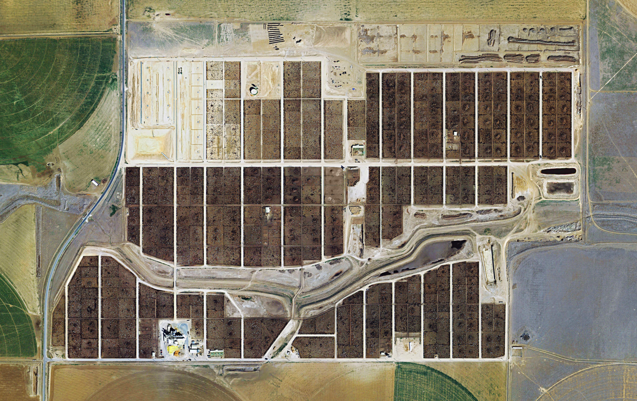
- Refer to Mishka Henner and Edward Burtynsky (aerial photographs) and The Boyle Family in your blog post…and discuss how they interact with an area and create art / photography inspired directly by the location and its uses / functions.
- Analyse and evaluate your process…show your selection, editing and presentation of final images.

What Are Archives?
In the course of daily life, individuals and organizations create and keep information about their personal and business activities. Archivists identify and preserve these documents of lasting value.
These records — and the places they are kept — are called “archives.” Archival records take many forms, including correspondence, diaries, financial and legal documents, photographs, and moving image and sound recordings. All state governments as well as many local governments, schools, businesses, libraries, and historical societies, maintain archives.
Your task
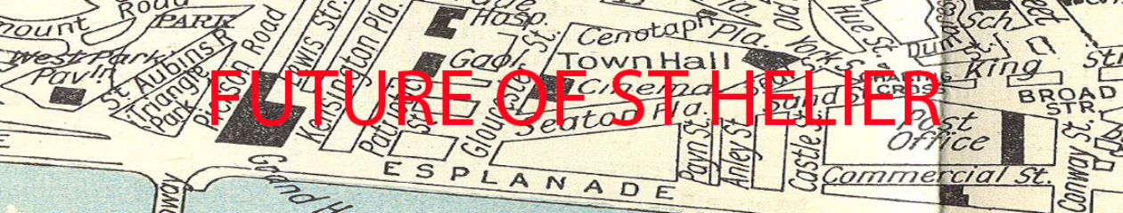
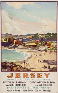
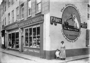
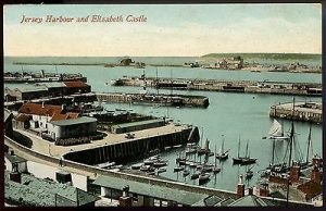
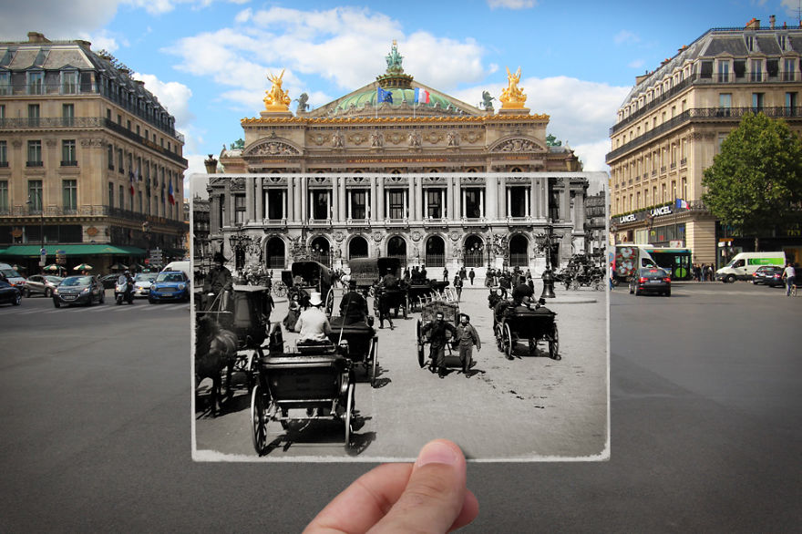
The images above are Archival Images from iconic areas of Jersey…and these areas have changed over time.
- Find archival images that correspond to your own landscape photography and contrast and compare. Include any info you can find about the image itself / photographer / time period etc
- OR…you may find that you are intrigued by a particular landscape image and want to respond to it and create a comparison / composite image. For this you must conduct a photo-shoot aiming to document the area from a similar viewpoint and edit your images accordingly
- OR…you may want to explore the concept of JUXTAPOSING Old and new buildings / parts of Jersey…either by photographing them in situ, or creating a composite image using photoshop
Public archives in Jersey
Jersey Archives: Since 1993 Jersey Archive has collected over 300,000 archival records and it is the island’s national repository holding archival material from public institutions as well as private businesses and individuals. To visit click here
Jersey Archive can offer guidance, information and documents that relate to all aspects of the Island’s History. It also holds the collections of the Channel Islands Family History Society.
Societe Jersiaise: Photographic archive of 80,000 images dating from the mid-1840s to the present day. 35,000 historical images in the Photographic Archive are searchable online here.
Societe Jersiaise also have an extensive library with access to may publications and records relating to the island’s history, identity and geography. Click here
Archisle: The Jersey Contemporary Photography Programme, hosted by the Société Jersiaise aims to promote contemporary photography through an ongoing programme of exhibitions, education and commissions.
The Jersey Evening Post Archives CLICK HERE
The Archisle project connects photographic archives, contemporary practice and experiences of island cultures and geographies through the development of a space for creative discourse between Jersey and international practitioners.
Link: http://www.archisle.org.je/
Extension Task
- Research and explore how Lewis Bush engages with and photographs the city and its development / over-development.
- Click here to check out an interview as he explains how he uses aerial / satellite imagery to home in on secret data stations used in the Cold War and produce abstract imagery influenced by the radio waves of secret information being mysteriously broad-casted.