This shoot will be at Noirmont point on Jersey’s south coast. I will fly a drone over a few specific locations on and around that headland. The locations I would like to shoot are Batterie Lothringen including the MP1 which covers the majority of the Noirmont headland, the Noirmont Point lighthouse and Janvrin’s Tomb in Portelet bay.


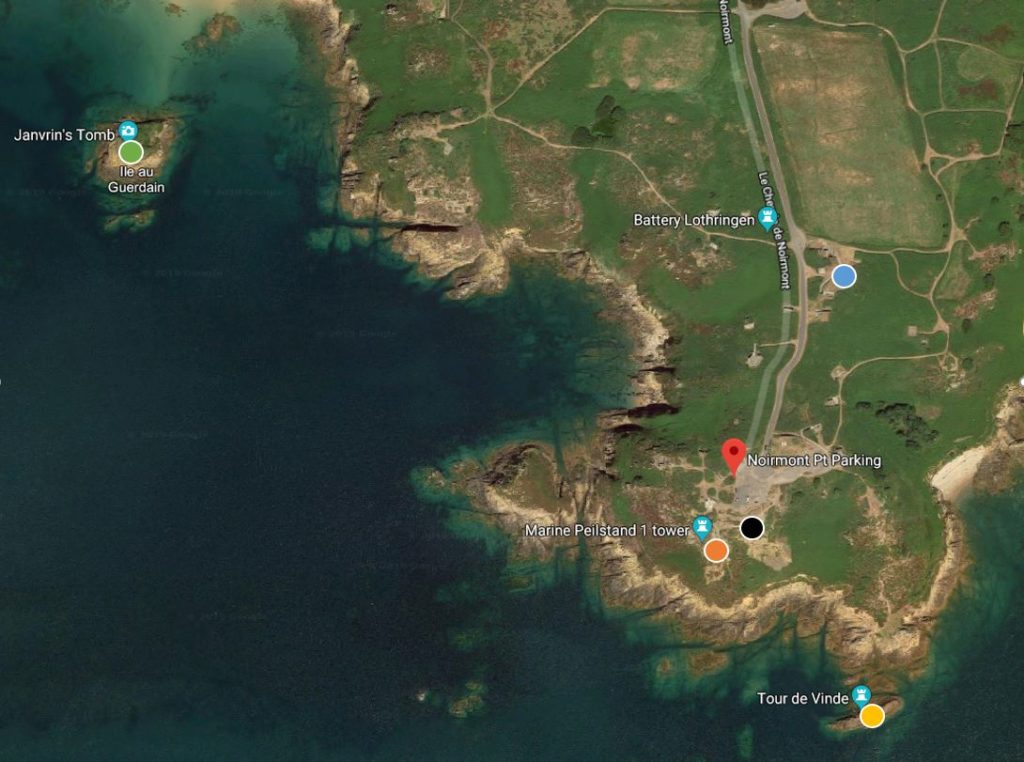
The satellite image below shows the locations I’d like to shoot, each colour coded by a coloured circle.
Green – Janvrin’s Tomb
Blue – Gun Point 1
Black – Gun Point 2
Orange – MP1 Tower + Range Finder
Yellow – Lighthouse

The aim of the shoot is to get top down images of locations that look like circles from above, I used satellite imagery to find the locations and also reviewed air laws and local airspace regulations to develop a plan and ensure the flight is within all regulations. The flight to Janvrin’s tomb takes the drone to it’s maximum legal distance but does not breach it, the location is just outside the Jersey Airport ATZ (Air Traffic Zone) yet we will still file a flightplan to let ATC (Air Traffic Control) know we are flying, giving location, time airborne, height and time down.
